The Tour du Mont Blanc does not announce its difficulty. The first morning out of Les Houches is almost pleasant — a well-graded forest path, cool air, the sound of cowbells from the alp above, Mont Blanc visible intermittently through the trees in a way that feels encouraging rather than intimidating. By the afternoon of day two, crossing the Col de la Seigne into Italy with a 45 km/h wind coming off the glacier and three hours of walking still ahead, the mountain reveals what it actually is: 168 kilometers of continuous alpine terrain, 10,000 meters of total elevation gain and loss, crossing three countries and seven major passes, in conditions that change without negotiation and reward preparation in ways that no other route in the Alps makes quite so clear.
The TMB is the route that produced the modern concept of hut-to-hut alpine trekking. It is also the route that most reliably separates walkers who have read about multi-day alpine travel from those who have done it. Not through dramatic danger — the path is well-marked, the huts are excellent, the infrastructure is the best in alpine Europe — but through the cumulative honesty of seven consecutive days at altitude with a full pack, changing weather, and the specific challenge of continuing on day five with the same quality of attention that day one demanded.
01Direction & Start Point
The TMB is walked conventionally anticlockwise — starting and finishing in Les Houches or Chamonix, proceeding south through France into Italy via the Col de la Seigne, west through the Val Veny and Val Ferret to the Swiss border, north across the Grand Col Ferret into Switzerland, and returning to Chamonix via the Swiss and French Prealps. The anticlockwise direction is not arbitrary: it places the most demanding ascents — Col de la Seigne, Grand Col Ferret — early in the route when legs are fresh, and delivers the gentler Swiss sections at the midpoint before the final French stage.
Hut Reservations
The TMB hut system runs at full capacity throughout July and August, and partial capacity from late June through mid-September. Every hut night must be reserved in advance — walking in without a booking in peak season means sleeping outside, which is a serious problem at 2,000 meters in a thunderstorm. Reservations open in January for the following summer season. Book through individual hut websites or the centralized TMB Booking platform:
- Refuge du Nid d'Aigle — night 1, France
- Rifugio Elisabetta — night 2, Italy
- Rifugio Bonatti — night 3, Italy
- Refuge de la Peule — night 4, Switzerland
- Refuge de la Flégère — night 5, France (or Refuge du Lac Blanc)
- Refuge de Bellachat — night 6, France
The hut system covers dinner and breakfast as standard for demi-pension guests. Pack lunches — carried from the hut each morning — are available on request. Budget approximately €70–95 per person per night for demi-pension in French and Swiss huts, slightly less in Italian rifugi.
Getting to Les Houches
- From Geneva Airport — train to Chamonix via Mont Blanc Express, approximately 2 hours. Change at Saint-Gervais.
- From Paris — TGV to Saint-Gervais, then Mont Blanc Express to Chamonix. Total approximately 6 hours.
- From Turin — train or bus to Chamonix via Courmayeur, approximately 3 hours.
Les Houches is one stop from Chamonix on the Mont Blanc Express. Start from Les Houches; it positions the opening stage correctly and avoids the logistical noise of beginning in Chamonix itself.
Spend one night in Chamonix or Les Houches before the first walking day. The Chamonix weather forecast is the most reliable mountain-specific forecast for the French section. Check it the evening before each stage. The alpine forecast diverges from valley weather significantly — what looks like a clear morning in Chamonix can mean a 60 km/h wind on the Col de la Seigne by 11:00 am.
02Day One: Les Houches to Refuge du Nid d'Aigle
Distance: 14km | Elevation gain: 1,200m | Estimated time: 6–7 hours
The first day establishes the TMB's baseline demand: sustained elevation gain on a well-graded path, through terrain that transitions from forest to open alp to exposed ridge in a progression that the body adapts to more slowly than the map suggests. The path climbs from Les Houches (1,007m) through the Merlet animal park section and the Chalets de Miage to the Refuge du Nid d'Aigle at 2,386 meters — a gain of nearly 1,400 meters across 14 kilometers that takes most walkers between 6 and 7 hours at a sustainable pace.
Forest to Alp
The first two hours through the Forêt de la Charme are the last two hours of genuine shelter the route provides until the Swiss valley sections on day four. The forest path is wide, well-surfaced, and cool in the morning — conditions that tempt a faster pace than the day's full elevation gain justifies. Resist it. The Chalets de Miage at the forest edge, where the path emerges onto open alp and Mont Blanc appears in full above the Bionnassay glacier, is the correct first stop: food, water from the trough, jacket assessment. The temperature above the treeline will be 6–8°C colder than the forest below.
The Ridgewalker GTX Boots are the foundation that the entire week rests on. Day one's 1,400-meter ascent is the equivalent of breaking them in under load — any fit issue that was tolerable on a day walk becomes a blister source by hour four on the first TMB stage. If there is a question about boot fit, it must be resolved before Les Houches, not after. The GTX membrane keeps the Chalets de Miage alp crossing dry through the morning dew — the grass above the forest holds moisture until 10:00 am regardless of overnight conditions — and the boot's ankle support becomes structurally relevant on the rocky path above the chalets where the trail loses its maintained surface.
Ridge Approach
Above the chalets, the path steepens, and the terrain becomes the rocky, loose-surfaced trail that characterizes most TMB high sections. The Altitude Carbon Poles are in active use from this point forward — not as balance aids on gentle ground, but as load-distributing tools on a sustained gradient that transfers meaningful strain from the legs to the upper body when used correctly. On a 14-kilometer, 1,400-meter day, the poles reduce leg fatigue by an amount that becomes clearly legible by day three when the cumulative difference between pole-users and non-users becomes visible in how each group descends to the huts.
The Nid d'Aigle hut sits directly above the glacier moraine with the Bionnassay ice face 200 meters above the terrace. The afternoon light on the glacier — when cloud allows — shifts the ice between blue and white in a progression the camera captures incompletely. Dinner is served at 7:00 pm. Be inside by 6:30 to claim a table position with the glacier view.
03Day Two: Nid d'Aigle to Rifugio Elisabetta (Via Col de la Seigne)
Distance: 18km | Elevation gain: 850m / loss: 1,100m | Estimated time: 7–8 hours
The second day crosses into Italy. The Col de la Seigne at 2,516 meters is the first major pass of the route and the point at which the TMB declares its actual character — an exposed saddle with no shelter, wind arriving from the Italian side in sustained lateral gusts, and a descent into the Val Veny on a rocky path that requires attention underfoot for the first 300 meters below the col.
The Col
The ascent to the Col de la Seigne from Refuge du Nid d'Aigle climbs through a boulder field and across a snow patch that persists into July before the saddle opens. Standing on the col with Italy below and France behind, Mont Blanc's southwest buttress directly overhead, the wind strong enough to require active lean — this is the moment the TMB stops being a long walk and becomes something with a different quality of demand. The Strata Alpine Softshell is the layer deployed here: zipped fully, collar up, providing wind resistance that a base layer alone cannot maintain at the col's exposure level without heat loss that will be felt on the 1,100-meter descent that follows.
The softshell's weather resistance matters throughout the TMB in a specific way — it handles the 80% of alpine weather events that are wind and light rain, the conditions that a hardshell technically outperforms, but that a hardshell's bulk and sweat management make impractical for a 7-hour walking day. The alpine weather pattern on the TMB is not a sudden, violent storm requiring full waterproof protection. It is a continuous shift between overcast, wind, light rain, and brief clearance that the softshell manages across the full range without requiring a stop to add or remove layers every 40 minutes.
Val Veny & Rifugio Elisabetta
The Italian descent into Val Veny passes through high alpine meadow — in July, the flower density on the Italian side of the col is genuinely extraordinary: gentian, edelweiss, alpine aster in concentrations that exist because the Italian section of the route sees dramatically fewer walkers than the French stages — before the Rifugio Elisabetta appears at the valley head at 2,195 meters. The rifugio's terrace faces the Miage glacier directly and serves Aosta Valley wine at a price that makes the 18-kilometer day feel adequately compensated.
04Day Three: Rifugio Elisabetta to Rifugio Bonatti
Distance: 16km | Elevation change: +500m / -600m | Estimated time: 6–7 hours
The third day is the Italian traverse — the Val Veny and Val Ferret section that tracks below the southern buttresses of the Mont Blanc massif through the quietest terrain on the entire circuit. The Italian stages of the TMB carry perhaps 30% of the walker numbers of the French equivalents, and the path quality — less maintained, less signposted, more honest — reflects the difference in traffic.
Courmayeur Decision
The trail passes through Courmayeur at the midpoint of the Italian traverse — a town worth stopping in for 45 minutes: espresso at Caffè della Posta, food resupply at the central alimentari if the hut-packed lunch supply is running thin, and a boot and blister check in a town rather than on a trail. The Altitude Merino Socks carry their full value across seven consecutive days specifically because wool manages the cumulative moisture and pressure distribution that multi-day walking in a single boot produces. A blister forming on day three that is not addressed in Courmayeur becomes a structural problem by day five. The merino's natural moisture management delays that timeline significantly — but it does not prevent it indefinitely, and Courmayeur is the correct place for the first serious foot assessment.
Rifugio Bonatti
Rifugio Bonatti — named for Italian alpinist Walter Bonatti, who lived his final years in these valleys — sits at 2,025 meters in the upper Val Ferret with a direct view of the Grandes Jorasses north face. It is the most architecturally considered rifugio on the Italian TMB section and serves the best dinner of any hut on the full circuit: polenta, carbonade valdostana, a local Aosta red, and a tiramisu that arrives in portions calibrated to seven-hour walking days. Eat everything. Tomorrow crosses into Switzerland.
05Day Four: Bonatti to Refuge de la Peule (Via Grand Col Ferret)
Distance: 14km | Elevation gain: 780m | Estimated time: 5–6 hours
The Grand Col Ferret at 2,537 meters marks the Italy-Switzerland border and the midpoint of the circuit. The ascent from the Val Ferret floor is a sustained 3-hour climb on a well-cairned path that gains 700 meters across open alpine meadow before the col's final rocky approach. The views from the col — looking back across the Italian Val Ferret to the Grandes Jorasses and looking forward into the Swiss Val Ferret toward Champex — provide the TMB's clearest geographic orientation: the full circuit visible in context, the distance covered and the distance remaining both legible in the landscape for the first time.
The Swiss Val Ferret
The Swiss descent is the gentlest on the circuit. The Val Ferret from the Swiss side is a pastoral valley — dairy farms, a tarmac road at the floor, the path running parallel above it through hayfields and larch forest — that arrives as a specific relief after three days of pure alpine terrain. The PureFlow Water Filter handles the meltwater streams crossing the descent path — Swiss mountain water is generally safe at altitude, but the geologic uncertainty above the tree line, combined with cattle use of the upper pastures, makes filtration the correct protocol regardless of visual clarity. Fill both bottles on the descent. The Refuge de la Peule has treated water, but a limited supply for trekkers arriving in the evening rush.
The Grand Col Ferret in afternoon thunderstorm conditions is a seriously exposed position. The alpine thunderstorm pattern in the Mont Blanc region between July and August typically sees storm development between 1:00 pm and 4:00 pm on unstable days. Depart Rifugio Bonatti by 7:00 am and target the col by 11:00 am. If the sky above the Grandes Jorasses is developing vertical cumulus by 10:30 am, move quickly. Lightning on an open col at 2,500 meters is not a theoretical risk.
06Day Five: La Peule to Chamonix Valley (Via Champex & La Flégère)
Distance: 22km | Elevation change: +700m / -1,200m | Estimated time: 8–9 hours
Day five is the longest day of the circuit and the one most likely to test the accumulated fatigue of the previous four days against the remaining distance. The route descends from Refuge de la Peule through Champex-lac — a small Swiss village on an emerald lake surrounded by pine, with a bakery that opens at 7:30 am and produces the most useful croissant of the entire week — before climbing through the Swiss Prealps and descending to the Chamonix valley at La Flégère.
The Fenêtre d'Arpette Option
Between La Peule and Champex, an alternative high route via the Fenêtre d'Arpette at 2,665 meters — the highest point on any TMB variant — provides a dramatically more demanding alternative to the standard valley path. The Fenêtre path adds 500 meters of elevation gain on a steep boulder field and scree approach, and should only be taken in stable weather and by walkers who have found the first four days comfortable rather than merely manageable. In ideal conditions, it is the finest single section of the entire TMB. In unstable weather, it is an exposed scramble above a boulder field with no shelter and no quick descent line. Check the forecast and decide at La Peule, not in advance.
La Flégère
The final ascent to Refuge de la Flégère at 1,877 meters arrives above the Chamonix valley with the full Mont Blanc massif — Aiguilles, Grandes Jorasses, the summit — visible across the valley in the evening light. After five days of walking around the mountain's perimeter, this is the first time the full mass of it appears simultaneously in a single view. The scale of what the circuit has circumnavigated becomes legible here in a way that the individual stages do not prepare for. Most trekkers stand at the refuge terrace for longer than they planned, not because the view is unexpected — they have been looking at Mont Blanc for five days — but because the accumulated context changes what seeing it means.
07Days Six & Seven: Return to Les Houches
Distance: Day 6 — 12km | Day 7 — 9km | Total elevation loss: 1,800m
The final two days traverse the French Prealps from La Flégère back to Les Houches via the Refuge de Bellachat and the high path above the Chamonix valley. The terrain is gentler than the earlier stages — lower elevation, more forest, better-maintained paths — but the knee load on sustained descents after six days of accumulated fatigue is where the Ridgewalker GTX Boots' ankle support and the Altitude Carbon Poles' descent braking become most actively felt rather than preventively useful.
The Descent Logic
Descents on days six and seven of the TMB are where equipment quality separates from equipment adequacy most legibly. A boot without adequate heel hold slips forward on steep descents, loading the toes in a way that produces toenail bruising — the TMB's most common finishing-day injury — that no blister management addresses. The Ridgewalker's heel cup prevents the forward slip. The poles' ergonomic grip, after six days of use, has adapted to the hand and functions without conscious management. This is what seven days of consistent equipment use produce: gear that has stopped being noticed and started being trusted.
The arrival back at Les Houches is without ceremony. The trail ends at the village square, the same square it left from seven days earlier. The mountain is behind you, still visible above the treeline, unchanged by the circumnavigation. The 168 kilometers of trail, 10,000 meters of elevation, three countries, seven passes, and six huts resolve not into drama but into a particular quiet competence — a recalibrated sense of what the body can sustain, what weather can be walked through, and what a mountain looks like when you have spent a week moving around its entire circumference.
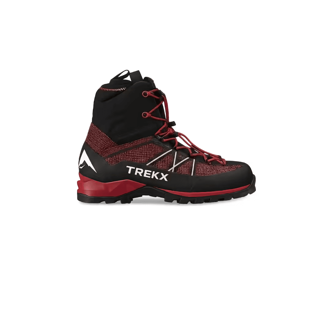
Ridgewalker GTX Boots
The foundation of seven consecutive days across 168 kilometers of mixed alpine terrain
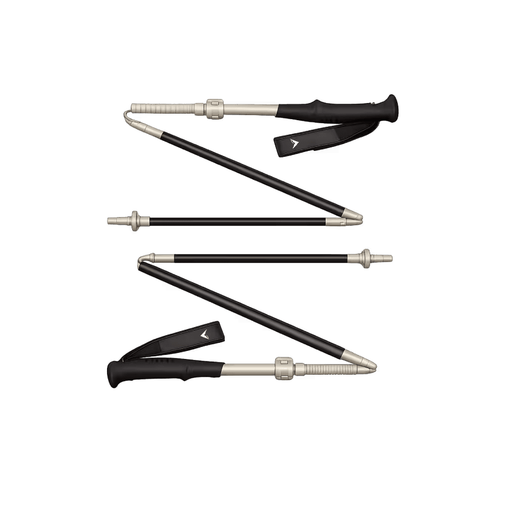
Altitude Carbon Poles
Distribute elevation gain load across upper body on sustained ascents and provide descent braking on 1,000-meter drops
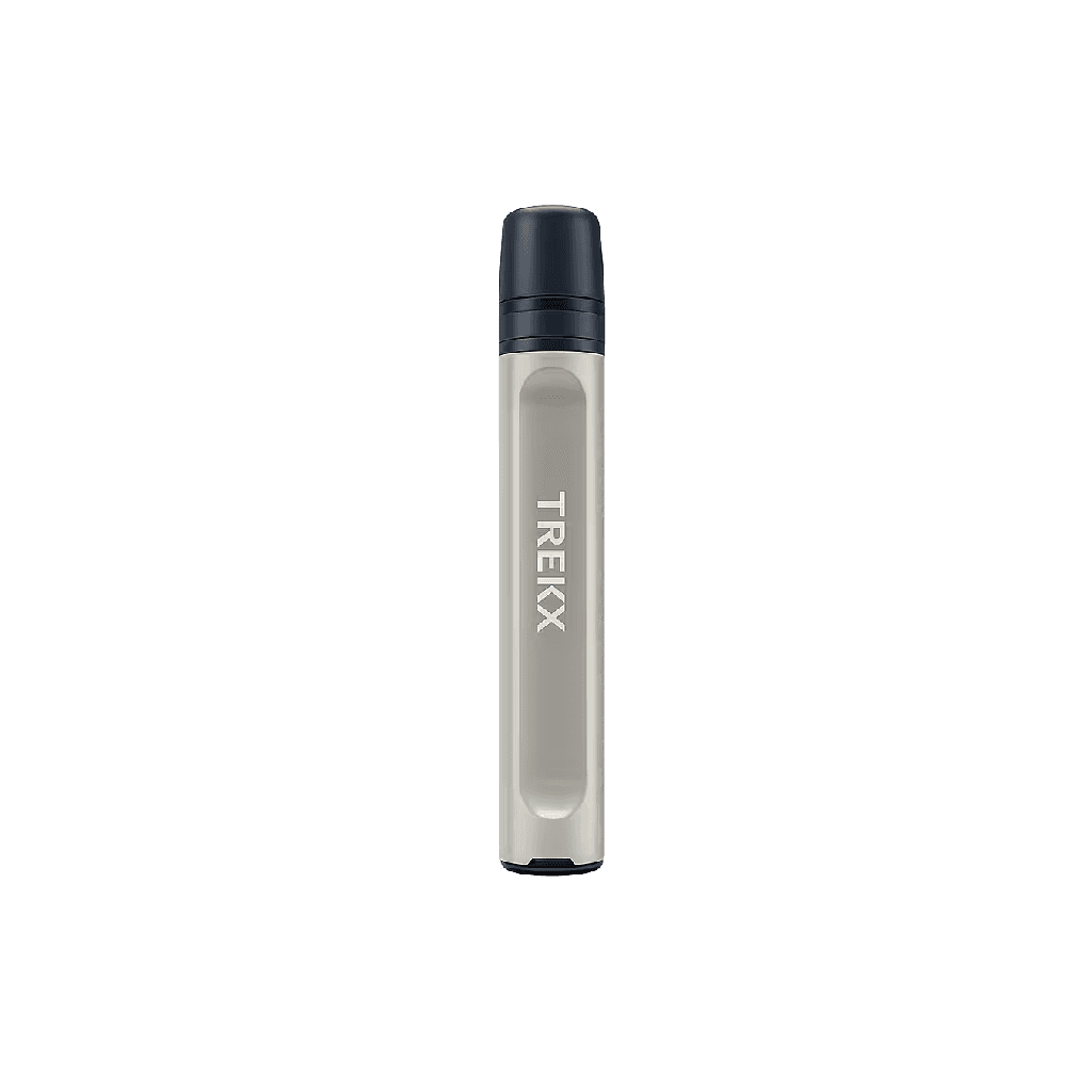
PureFlow Water Filter
Provides reliable water from meltwater streams and alpine sources across the Italian and Swiss sections where hut water supply is limited
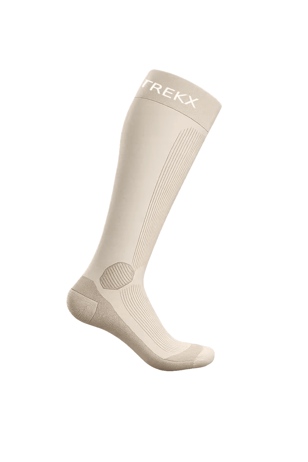
Altitude Merino Socks
The layer that delays blister formation long enough to reach Courmayeur for the first foot assessment rather than addressing it on the trail
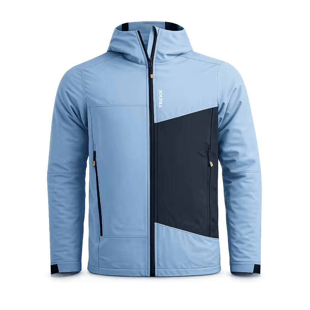
Strata Alpine Softshell
Handles the 80% of The Mont Blanc weather that is wind and light rain
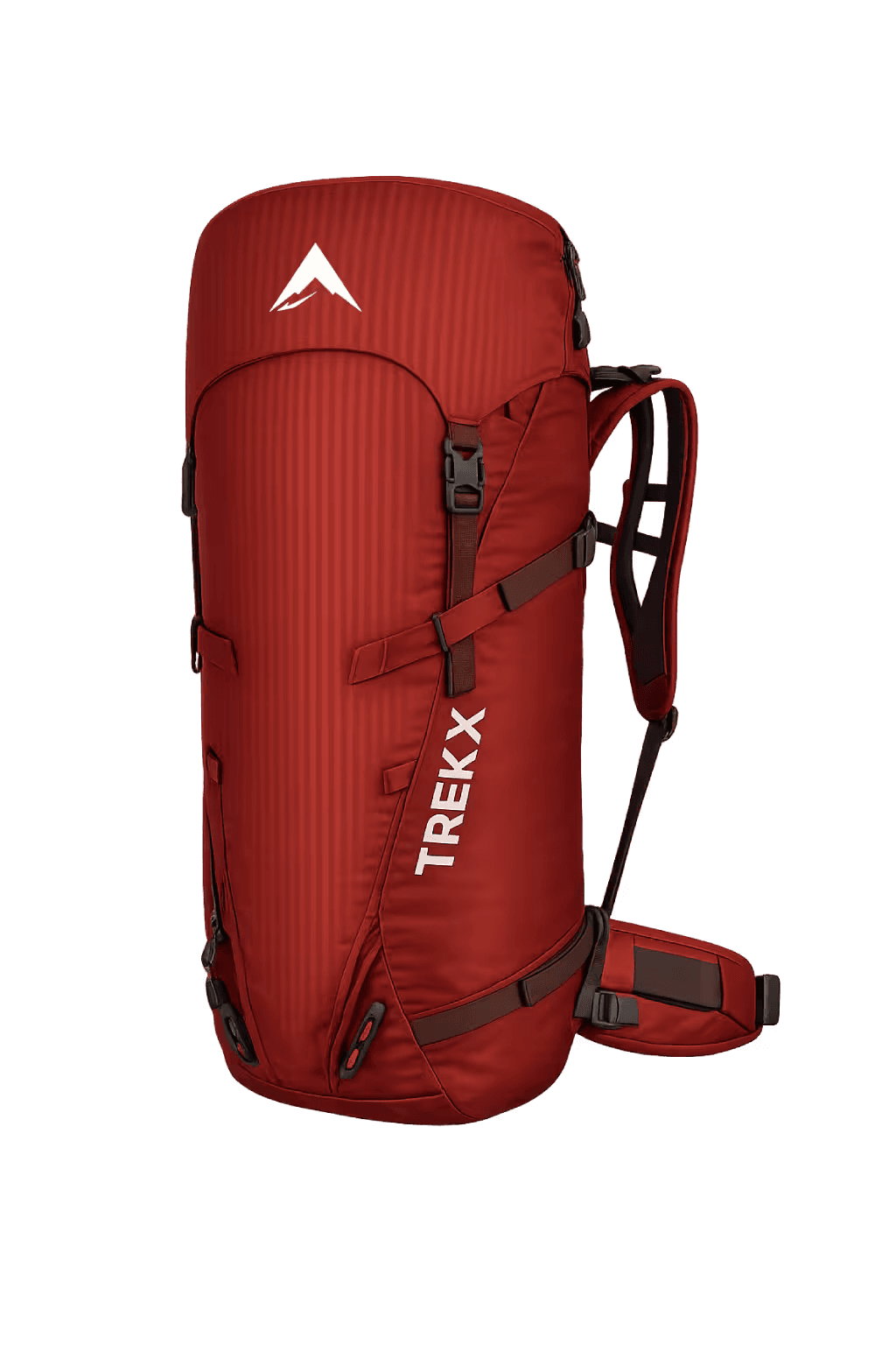
Altitude Trek Pack
Carries the full seven-day load across a circuit where daily pack weight management and hip belt fit directly affect the quality of movement on stages that run to nine hours