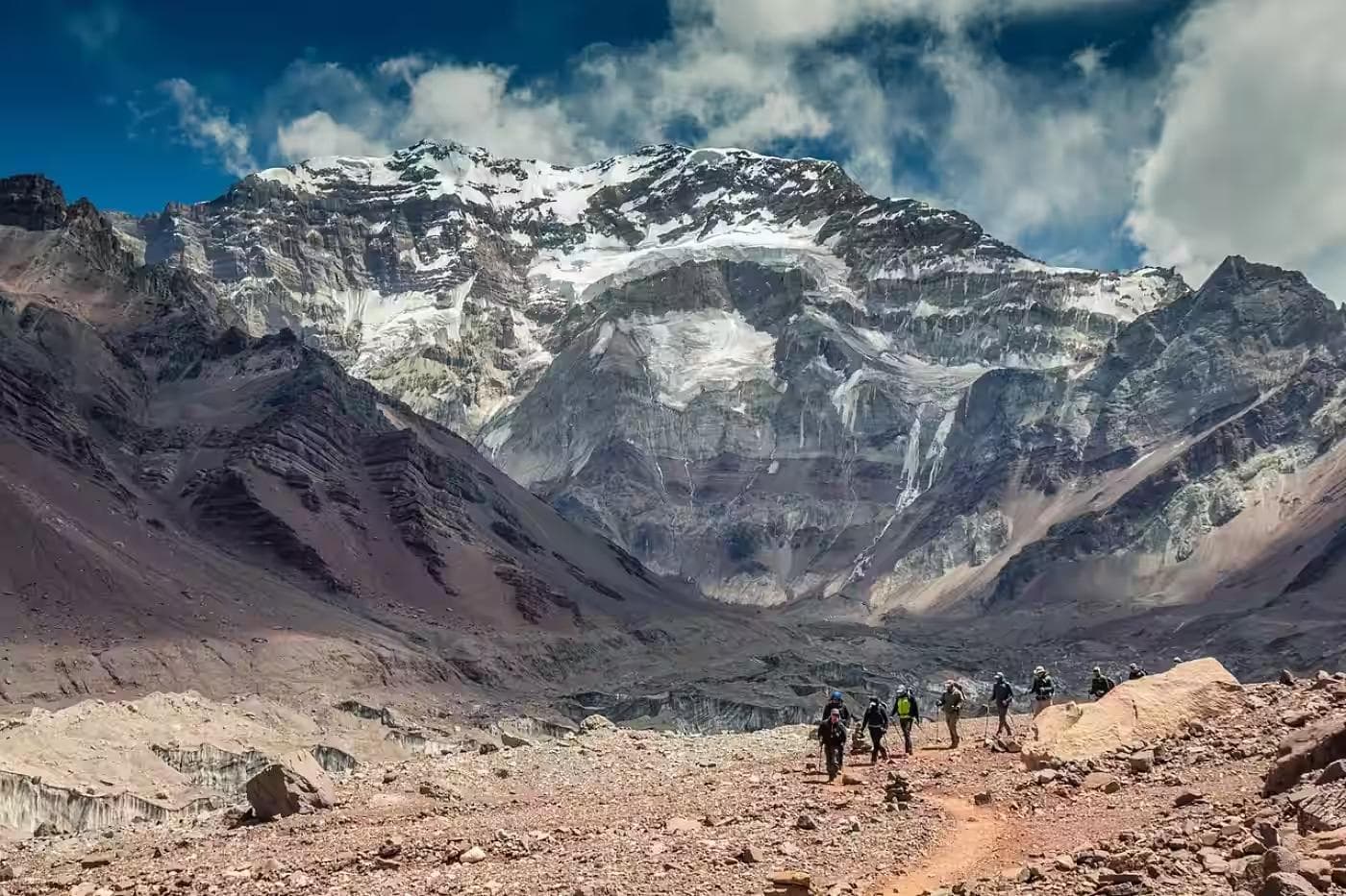
Aconcagua does not reveal itself from the road. The approach from Mendoza follows the Río Mendoza canyon through the Andes foothills — dry rock, sparse scrub, the river grey with glacial sediment — and the mountain stays hidden behind its own geology for the full two-hour drive. Then the road curves at Puente del Inca, and the south face appears: 6,961 meters of glaciated rock wall rising from a valley floor at 2,700 meters in a single continuous lift that the eye refuses to process as a single object for the first several seconds. The scale is not photogenic. It is structural. It rearranges something in the spatial imagination that does not return to its previous configuration.
This guide covers the Vacas Valley approach to Plaza Argentina base camp — the eastern approach to Aconcagua at 4,300 meters, used by Polish Glacier route climbers and increasingly by trekkers with no summit ambition who come for the approach itself. Fourteen days from Mendoza and back provides enough time for the acclimatization that altitude above 3,500 meters requires, the full approach to base camp, and two rest days that the body will ask for without being scheduled. This is not a summit itinerary. It is an altitude trekking itinerary in one of the most geologically extraordinary landscapes in the Southern Hemisphere — and it is a more honest engagement with Aconcagua than the summit statistics suggest for most visitors.
01Mendoza First
Everything begins in Mendoza — Argentina's wine capital and the administrative gateway to Aconcagua. Permits are issued exclusively by the Aconcagua Provincial Park authority at the park office on Avenida San Martín in Mendoza city. The trekking permit — covering the approach to base camp without summit attempt — runs approximately USD $300–400 depending on season, payable at the office with passport. The full summit permit runs USD $800–1,200 and covers a different logistical framework entirely.
Spend two nights in Mendoza before the mountain. The gear shops on Avenida Las Heras stock everything that altitude demands and forgets — including gas canisters for the stove, which cannot be transported by air. The Aconcagua Trek agency provides mule hire for the approach, which is not optional for a 14-day trekking itinerary: carrying full camping kit and two weeks of food from the Vacas Valley trailhead to Plaza Argentina without mule support is a physical undertaking that degrades the acclimatization quality the altitude requires.
Mule Logistics
Mules carry the main load — tent, sleeping system, food, cooking equipment — between the trailhead at Los Penitentes and the base camp at Plaza Argentina. The trekker carries a day pack with water, layers, a camera, and the day's food. Book mule support through a registered agency in Mendoza before arrival; independent mule hire at the trailhead is possible, but prices and availability are unreliable in the January peak season.
Register the trek with the Safe Travel Argentina system and with your home country's embassy in Buenos Aires before departing Mendoza. Aconcagua's Vacas Valley approach has no mobile signal between the trailhead and base camp. A satellite communicator — Garmin or GPS device — is the emergency infrastructure that replaces phone connectivity for the full approach duration.
02Days One–Two: Mendoza to Puente del Inca
The drive from Mendoza to Puente del Inca on the RN7 covers 165 kilometers through the Andean precordillera, gaining elevation continuously from 750 meters at the city to 2,720 meters at the roadside village. The precordillera in December is summer-dry and warm at road level — the vegetation sparse, the rock faces stratified in horizontal colour bands of rust, ochre, and pale grey that geologists date to separate eras of marine sediment deposit. The elevation gain happens faster than the body registers. A headache arriving in the late afternoon at Puente del Inca is not dehydration. It is the first communication from an atmosphere that contains 25% less oxygen than Mendoza's.
Puente del Inca itself — a natural stone bridge formed by mineral-rich thermal springs — is the last permanent settlement before the mountain. The thermal springs deposit yellow and orange mineral crusts on everything they contact, including the ruins of a 1930s hotel that now stands half-dissolved in the deposits, the walls painted in involuntary colours. It is one of the stranger landscapes in the Andes at this elevation, and it serves as a useful reminder that the geology here is active and indifferent to human infrastructure in ways that most mountain landscapes are not.
Rest here for the full second day. Walk no more than two kilometers at elevation. Eat well, drink three liters of water minimum, and sleep as much as the altitude permits. The acclimatization debt taken on by ignoring this rest day compounds at every subsequent elevation gain.
03Days Three–Five: Vacas Valley Approach
Distance: 38km to base camp | Daily distance: 12–15km | Elevation gain: 1,580m total
The trailhead at Punta de Vacas — 15 kilometers south of Puente del Inca on the RN7 — marks the beginning of the approach. The Vacas Valley route is the less-trafficked eastern approach to Aconcagua, used by a fraction of the walkers who take the more popular Horcones Valley route to Plaza de Mulas on the north side. The eastern valley is drier, more remote, and geologically more dramatic — the valley walls are banded sedimentary rock at a scale that makes the path at their base feel provisional. The river is present throughout and the trail crosses it twice on log bridges whose structural confidence is best not examined too closely.
Terrain & Load
The FlowRidge Hydration Pack is the daily carry system for the full approach. In Andean summer conditions — dry air, strong UV, temperatures that swing 25°C between midday and midnight — hydration management is the primary physiological task that the approach requires. Above 3,000 meters, the dry air accelerates moisture loss through respiration in ways that thirst signals fail to track accurately. The FlowRidge's bladder allows continuous drinking without stopping — critical in sections where stopping means the cold finds the sweat layer before a jacket can be added — and the 2-liter capacity covers the distance between the Vacas River crossing points, where the PureFlow Water Filter draws from the river source.
The river water here is glacially cold, visually clear, and carries glacial sediment and upstream livestock contamination that makes filtration the correct protocol regardless of how pristine the source appears. Filter at every crossing. Carry two full liters minimum into each camp. Above 3,500 meters, the filtration habit that was a precaution at lower elevations becomes a dependency — the river crossings thin out, the water sources become less predictable, and the dehydration that altitude produces means the system carries no margin for a missed fill.
Camp Confluencia (3,400m)
The first camp — Confluencia, where the Vacas and Relinchos rivers meet at 3,400 meters — is a flat gravel plain in a wide section of the valley with the mountain's eastern buttresses visible for the first time above the valley wall. The south face of Aconcagua from Confluencia is the view that provides the first honest sense of what the mountain actually is: not the photogenic pyramid that the postcard shows, but a massive, irregular bulk of rock, glacier, and accumulated geology that fills the entire southern sky above the valley.
The Thermagrid Fleece is the layer that makes the evening camp functional rather than merely endured at this elevation. The temperature drop between 4:00 pm and 7:00 pm at Confluencia in December is approximately 18°C — from warm afternoon sun to below-zero wind chill as the valley shadow arrives. The fleece goes on at the moment movement stops and stays on through dinner, the evening weather check, and until the sleeping bag takes over. Its grid construction retains warmth in the wind-exposed valley camp in a way that a plain fleece does not — the grid traps air regardless of wind pressure, rather than losing insulation when the surface is compressed by sustained wind.
Acute Mountain Sickness (AMS) symptoms — persistent headache, nausea, loss of appetite, disrupted sleep — at Confluencia are the body's communication that the acclimatization schedule requires adjustment. Do not ascend with AMS symptoms. The correct response is a rest day at the same elevation or, if symptoms worsen, descent to Puente del Inca. The altitude above Confluencia offers no recovery margin for a compromised physiological state. Carry acetazolamide (Diamox) if prescribed by a physician before departure — it does not eliminate AMS, but it reduces the severity of the acclimatization curve significantly at this elevation bracket.
04Days Six–Eight: Relinchos Valley to Plaza Argentina
Distance: 15km | Elevation gain: 900m to 4,300m | Daily distance: 5–8km
Above Confluencia, the valley narrows, and the Relinchos tributary leads southeast toward the mountain's eastern glacier system. The terrain here changes character entirely — the wide gravel river plain of the lower Vacas Valley gives way to a narrowing gorge of dark rock, the path steeper and less defined, the glacier moraines appearing on the valley flanks as evidence that the ice that carved this landscape retreated not long ago in geological terms. The Ridgewalker GTX Boots earn their full load on this section: the moraine terrain is unstable in a specific way — individual rocks that appear stable shift underfoot on the loose sediment below them — and the ankle support of a structured boot is the difference between a recoverable stumble and a rolled ankle at 4,000 meters, which is a problem with no proximate medical solution.
Scree & Dust
The TrailGuard Gaiters become essential above 3,800 meters. The Aconcagua approach's scree and volcanic dust penetrate the boot-trouser gap on every step of the moraine sections — not merely uncomfortable but abrasive enough to produce blisters on the lower ankle that no sock weight addresses. The gaiter's mid-height cut handles the scree sections without the excess bulk of a full mountaineering gaiter, which the approach terrain does not require.
Plaza Argentina (4,300m)
Plaza Argentina base camp at 4,300 meters is the itinerary's high point and destination. The camp occupies a flat glacial plain below the Polish Glacier on the eastern face — a wide, wind-scoured space of grey gravel surrounded by the eastern buttresses of the mountain, with the glacier above it and the Relinchos Valley below it disappearing into haze at mid-morning. The altitude here is felt in everything: the rest step on the final approach, the reduced appetite at dinner, the specific quality of the cold that dry Andean air produces — not the wet cold of maritime mountains but a desiccating cold that strips moisture from exposed skin and from the respiratory system simultaneously.
Spend two nights at Plaza Argentina before the descent. One acclimatization walk to 4,500 meters and back — no more — calibrates the body's response to the altitude without loading the legs for the descent. The descent from base camp to the trailhead is faster in distance but more demanding on the knees than the ascent, and arriving at the trailhead with adequate physiological reserves rather than a depleted system is the correct completion of a two-week altitude itinerary.
High Altitude Pulmonary Edema (HAPE) and High Altitude Cerebral Edema (HACE) are medical emergencies that can develop above 4,000 meters without warning. Symptoms of HAPE include breathlessness at rest, persistent cough, and crackling sounds in the chest. Symptoms of HACE include severe headache unresponsive to ibuprofen, loss of coordination, and confusion. Both conditions require immediate descent — not rest at altitude, not monitoring, immediate descent — and evacuation to medical care. The Aconcagua park rangers maintain an emergency post at Plaza Argentina with basic medical equipment and radio communication to Mendoza. Know its location on arrival at camp.
05Days Nine–Twelve: Descent & Mendoza Recovery
The descent from Plaza Argentina to the Punta de Vacas trailhead reverses the approach in two days rather than three — the body moves faster descending than ascending, and the improving oxygen availability below 3,500 meters accelerates recovery in ways that feel almost pharmaceutical by the time the RN7 is reached. The valley that appeared vast and dry on the approach reads differently on descent: smaller, more familiar, the landmarks are now places rather than unknown terrain.
Two nights in Mendoza before the return flight is the correct conclusion. The Mendoza restaurant and wine culture — the malbec, the asado, the unhurried dinner pace of an Argentine summer evening — provides a decompression from two weeks of altitude and caloric deficit that the body receives as disproportionately restorative. Eat red meat. Drink the local wine. Sleep in a flat-ground bed at 750 meters where the oxygen is 25% more abundant than it was a week ago, and notice that this, too, is something the body registers directly.
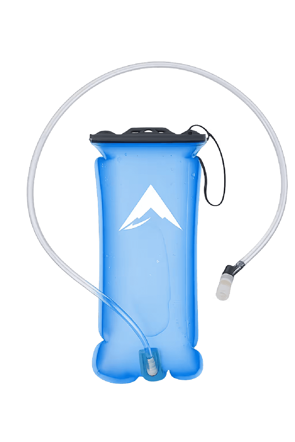
FlowRidge Hydration Pack
Continuous drinking without stopping across a dry high-altitude approach where dehydration outpaces thirst signals
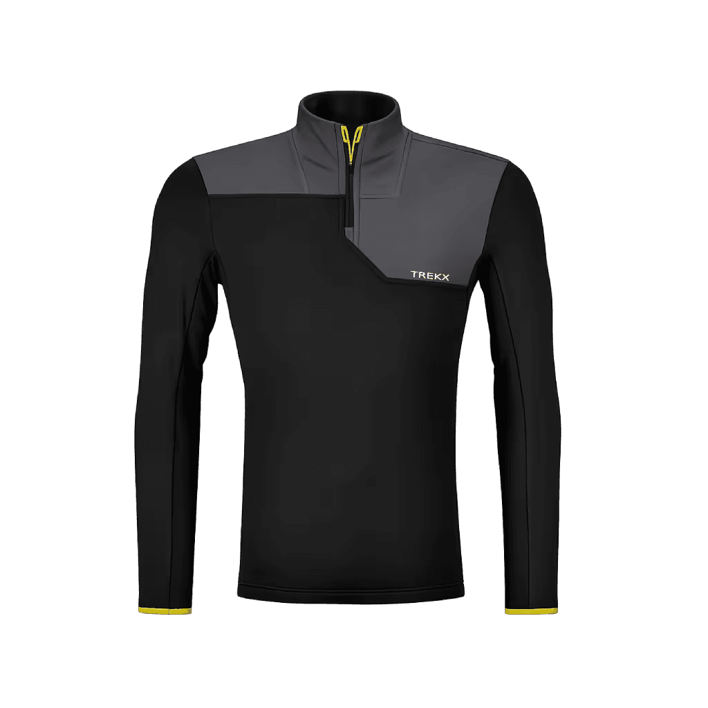
Thermagrid Fleece
The layer that covers the 18°C evening temperature drop at camp. It makes high camp evenings functional rather than a race to the tent
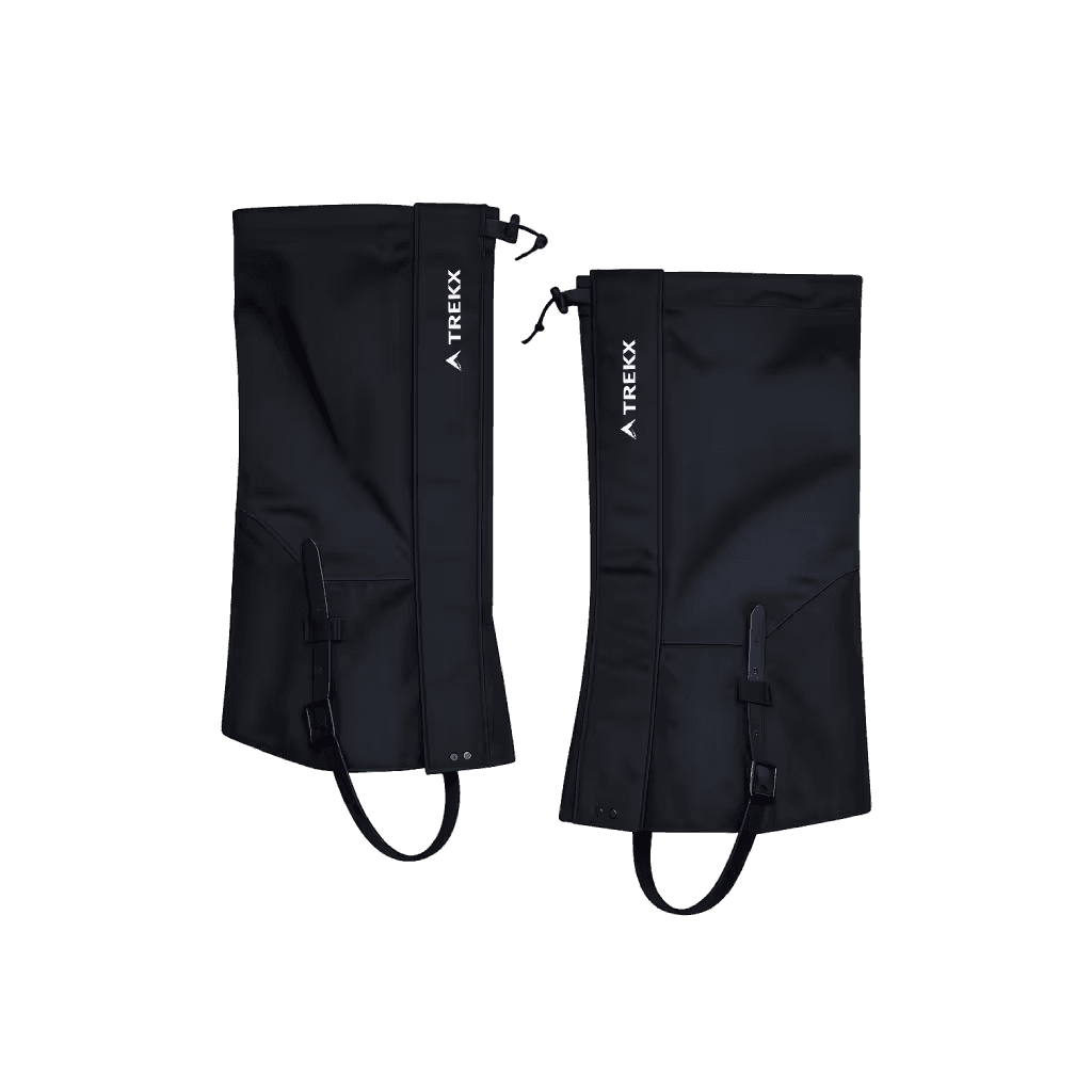
TrailGuard Gaiters
Seals the boot-trouser gap against the volcanic dust and scree above 3,800 meters
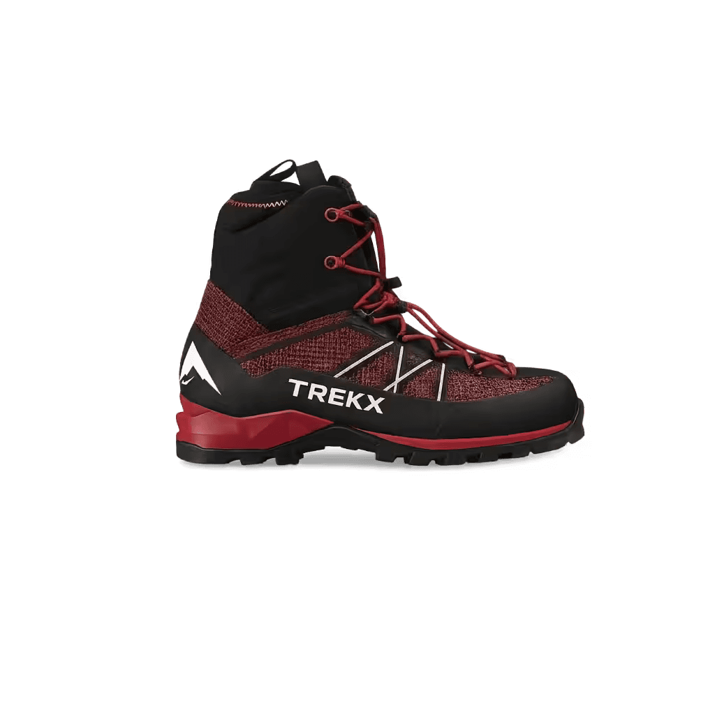
Ridgewalker GTX Boots
Ankle support on unstable moraine and structured heel hold on sustained scree descent
PureFlow Water Filter
Draws clean water for 14 days from the Vacas and Relinchos rivers across the full approach