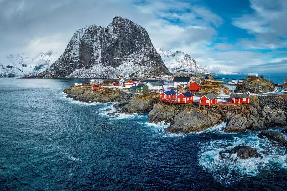
There is a specific quality of light in the Lofoten Islands at 11:00 pm in July that photographers travel from every continent to find. The sun sits just above the horizon — or just below it, producing the civil twilight that the high Arctic substitutes for actual darkness — and the light it throws across the sea and the peaks is horizontal, warm-toned, and of a duration that does not exist at any other latitude. The Lofoten peaks catch it from the west and turn amber. The sea below them, the Vestfjorden, goes from grey-green to a colour that has no exact name in any language. The fishing villages — red-painted rorbuer on their stilts above the water — absorb it and glow. All of this lasts for two hours, then begins again. In June and July, it never fully stops.
The Lofoten Islands extend 170 kilometers into the Norwegian Sea from the mainland at 68 degrees north, connected by bridges and tunnels across a chain of islands whose geology produced something that has no equivalent in Scandinavia: fjord walls that rise directly from the ocean without the gradual valley approach that continental fjordland requires, peaks that appear to emerge from the sea itself, a coastline that oscillates between white sand beach and vertical granite without transition. The walking here is compact by distance and serious by character. The peaks are not high — the maximum elevation on this itinerary is 900 meters — but they are steep, exposed, and coastal, which means the wind and the weather and the terrain combine in a way that altitude alone does not produce.
01Getting to Lofoten
The islands are accessible by three routes from mainland Norway, each with its own logic:
- Bodø to Moskenes ferry — the classic approach. Three to four hours crossing the Vestfjorden, arriving at the southern end of the archipelago. Runs daily with vehicle spaces; book in advance for summer travel. The crossing in calm conditions is a spectacle: the Lofoten Wall — the continuous mountain ridge of the islands — rises from the water ahead for the full final hour of the journey.
- Harstad/Narvik Airport (EVE) — the fastest international connection, with daily flights from Oslo. Car rental at the airport and a 2.5-hour drive south via the E10 connects to Svolvær, the main island town.
- Oslo to Bodø by train — overnight Nordlandsbanen service, approximately 17 hours. A deliberate journey for those who want the Norwegian geography to arrive gradually rather than suddenly.
Base & Car
A rental car is non-negotiable for this itinerary. The trailheads for the four routes described are spread across the islands' 170-kilometer length, and the Lofoten bus network runs infrequently and times poorly for early-morning trailhead starts. Svolvær is the base — the largest town on the islands, well-supplied with supermarkets, gear shops, and accommodation, and centrally positioned between the northern and southern trailheads.
For accommodation, the two nights not spent camping: Svolvær Sjøhuscamping offers both cabins and tent pitches directly on the harbour, providing the practical base that the two camping nights require.
Book the Bodø–Moskenes ferry with a vehicle space at least 6–8 weeks ahead for July crossings. Summer vehicle capacity sells out consistently, and arriving in Bodø without a ferry booking means either leaving the car and hiring on the islands — expensive and limiting — or waiting multiple days for a space. Book directly through Torghatten Nord.
02Day One: Ryten & Kvalvika Beach
Distance: 10km | Elevation gain: 543m | Estimated time: 4–5 hours
The first day establishes Lofoten's fundamental character: a short trail by distance that delivers far more than the numbers suggest, combining a summit viewpoint with a beach descent so improbable in this latitude that the first view of it from the ridge produces a response closer to disbelief than recognition. The Ryten summit trail begins at the Fjelldalen parking area on Moskenesøya, the southernmost inhabited island of the main chain, 2.5 hours south of Svolvær on the E10.
The Ascent
From the parking area, the trail climbs immediately through heather moorland before reaching the lower shoulder of Ryten at approximately 300 meters. The path is clear but steep — loose stone sections alternate with firm rock slabs that require hands in two or three places, nothing technical, but sustained enough that the effort is real from the first kilometer. The SummitTraverse Pants are the practical layer for Ryten's terrain: the rock slab sections above 400 meters require a freedom of knee movement that rigid fabric restricts, and the coastal wind above the shoulder — arriving cold off the Vestfjorden regardless of the air temperature below — requires a fabric weight that trail running shorts do not provide. The articulated cut of the SummitTraverse handles both the movement demand and the wind exposure without requiring a stop to add or remove a layer for each transition.
Ryten Summit
The summit at 543 meters delivers the view that the Lofoten is known for internationally: directly below the eastern edge of the summit plateau, the beach of Kvalvika — white sand, 400 meters long, hemmed on three sides by vertical peaks and open to the sea on the fourth — sits 400 meters below in a colour contrast so extreme it reads as artificial. Turquoise water against white sand against dark granite against blue sky. The scale of the peaks surrounding the beach makes it appear miniature from the summit. From the beach itself, the scale inverts.
The descent to Kvalvika is steep, loose, and requires deliberate downhill footwork on a scree path that the coastal wind makes unpredictable in gusts. Moving sideways to the wind on a loose descent with a pack is where the SummitTraverse's freedom of movement becomes structurally relevant rather than merely comfortable — a fabric that binds at the knee on a lateral step is a balance liability on this particular descent. Take the path slowly and use the flat rock sections to regroup pace between the steeper scree runs.
Kvalvika Beach Camp
Camp on the beach under Allemannsretten. The Stormridge 3 Tent goes up on the upper beach above the tide line — the lower sand is firmer, but the overnight tide in July reaches further than the calm afternoon sea suggests. The beach is sheltered from the prevailing southwest wind by the surrounding peaks, which makes it one of the more protected camping positions in the southern Lofoten despite its apparent exposure. The midnight sun on Kvalvika beach at 11:30 pm, with the peaks above it amber-lit and the sea below them glass-still on windless evenings, is the image that brought half the photographers on this trail here in the first place.
The PeakBeam Torch is functionally unnecessary on Kvalvika in June and July — the light does not drop below navigable levels. It becomes relevant at 3:00 am when the need for the bathroom takes a trekker past Stormridge's guy wires in the dimmest point of the midnight-sun cycle, and on the following morning's early start when the path back up the Ryten scree requires reading the ground surface before the sun clears the eastern peak. Pack it in the tent pocket rather than the main bag.
Kvalvika beach is accessible only on foot. Emergency evacuation from the beach requires either the return over the Ryten scree or a sea approach. Check the Norwegian meteorological service yr.no forecast for wind and sea state before camping there overnight. A storm that arrives during the night makes the Ryten descent genuinely dangerous in wet conditions, and the alternative is waiting on the beach for conditions to improve — which in Lofoten can mean waiting longer than the itinerary allows.
03Day Two: Svolværgeita
Distance: 6km return | Elevation gain: 600m | Estimated time: 5–6 hours
Return to Svolvær on day two and, in the afternoon, attempt the most technically demanding walk of this itinerary: the approach to the base of the Svolværgeita — the twin granite horns above Svolvær that define the town's skyline and appear in every Lofoten photograph taken from the harbour. The horns themselves require climbing equipment and rope technique to summit; the approach to the saddle below the horns at approximately 550 meters is a steep scramble within the capability of a trekker comfortable with using hands on rock.
Town to Treeline
The trail begins directly from Svolvær town center — a 10-minute walk from the harbour to the trailhead marker at the base of the mountain, the path rising immediately through pine and birch before the treeline ends and the rock begins. The lower section is a good path, well-worn and clear. Above 200 meters, it becomes a route rather than a path — cairned, directionally obvious, but requiring interpretation of the terrain rather than simply following a line.
Scramble Section
Above 400 meters, the route crosses a series of rock slabs and short vertical steps — none higher than 4 meters, all with positive holds, all within the capability of a trekker who is comfortable with exposure. Comfortable with exposure is the operative condition. The Svolværgeita approach has significant drops on its western side, and the rock becomes greasy when wet. In dry conditions, it is an exciting scramble with extraordinary views. In wet conditions, it is a route that requires reassessment at every step. The SummitTraverse Pants provide the knee mobility that the steeper step sections demand — a move that requires lifting the knee to chest height on a rock step is the move that tests fabric stretch at the precise moment when balance requires full attention, rather than compensation for restricted movement.
The saddle below the horns at 600 meters provides the defining Lofoten view from altitude: Svolvær harbour directly below, the Vestfjorden extending south toward the mainland, the Lofoten Wall visible in both directions along the island chain. The horns above are vertical and enormous at this proximity — the perspective from the approach path makes them appear smaller than the harbour view suggests, and standing below them corrects that impression immediately.
Northcrest Beanie
The saddle is exposed to the full northwesterly on this side of the ridge — the wind at the saddle hits the coastal speed that the peaks below channeled and focused before releasing onto the exposed rock at 600 meters. The Northcrest Beanie is the layer that makes the 30-minute rest at the saddle a pleasure rather than a cold endurance exercise. At coastal altitude in Lofoten, the heat loss through an uncovered head in 30 km/h wind is fast enough to change the quality of a rest stop from recovery to accelerated cooling — the beanie weighs 72 grams and compresses to the size of a fist in the SummitTraverse hip pocket. It earns that pocket on this saddle and on every cold camp evening throughout the itinerary.
Descend the Svolværgeita approach by 4:00 pm regardless of conditions. The afternoon sea breeze on the western Lofoten coast strengthens consistently between 2:00 pm and 6:00 pm throughout summer, and the slab sections above 400 meters in wet wind require a confidence of footing that fatigue and gusting conditions work against simultaneously. The view from the saddle does not improve in the late afternoon. The descent quality does not improve either.
04Day Three: Reinebringen
Distance: 4km return | Elevation gain: 448m | Estimated time: 2–3 hours
The third day returns south to Moskenesøya for the most-walked summit in the Lofoten — Reinebringen above the village of Reine — and the most photographed view in Norway. The trail has been recently upgraded from an eroded mountain path to a Nepalese-built stone staircase — 1,500 hand-laid steps ascending the western face of the peak — which has made the route accessible to a far wider range of walkers while making the ascent more sustained and leg-intensive than the previous scramble-based approach.
The Staircase
The staircase is not subtle. It rises directly up the face of Reinebringen without switchbacks or gradient relief — a straight line of stone from sea level to the ridge at 448 meters that arrives at the summit in approximately 90 minutes at a consistent pace. The steps are well-constructed, and the footing is reliable in dry conditions. In the rain, the stone surface becomes slippery in a way that the step height — some steps 35–40 centimeters — makes consequential. Check the morning forecast and start early. The summit crowds arrive by 9:00 am in July; the 6:30 am departure bracket provides a summit window of 30–45 minutes of near-solitude before the first group ascents reach the top.
The View
The Reinebringen summit view is the canonical Lofoten image: the village of Reine below on its island promontories, the surrounding peaks reflected in the dark fjord water, the fishing boats at the dock reduced to dots, the mountain geometry of the surrounding islands arranged in a composition that appears designed rather than geological. In clear summer light before 8:00 am, with the sea still and the peaks clear, it is the single most concentrated version of what Lofoten looks like from the outside — and from the inside of it, after three days of walking its terrain and camping on its beaches, the view carries a context that the photographs do not.
Reine Village
Descend to Reine and spend the afternoon in the village. Reine is small enough that 45 minutes covers its full geography, but interesting enough that 45 minutes is not sufficient — the Lofoten Stockfish Museum documents the cod fishing industry that built the archipelago over 1,000 years, and the harbour-front café operates on the schedule of the fishing boats rather than the tourist buses. Eat the fish soup. Drive back to Svolvær for the final night before day four.
05Day Four: Tjeldbergtinden & Departure
Distance: 8km return | Elevation gain: 700m | Estimated time: 4–5 hours
The final day climbs Tjeldbergtinden — a 700-meter peak above the village of Kabelvåg, 5 kilometers south of Svolvær — for the itinerary's highest summit and most sustained ridge walk. The trail begins at the Kabelvåg church parking area and climbs northeast through open heather and birch scrub before the ridge narrows, and the summit section begins.
Ridge Walking
The upper section of Tjeldbergtinden is a narrow ridge with drops on both sides — not technical, not requiring rope, but genuinely exposed in the sense that a misstep has clear consequences and the wind at 700 meters above the Vestfjorden is the coastal wind without any valley mediation. The Northcrest Beanie goes on at the first ridge narrows — the wind here is cold, direct, and consistent in a way that the protected scramble sections of the previous days did not produce — and the SummitTraverse Pants handle the lateral step movements that the ridge's terrain requires at several points where the path crosses below outcrops on the seaward side.
Final Summit
The Tjeldbergtinden summit at 709 meters provides the full northern Lofoten panorama: Svolvær visible to the south, the Svolværgeita horns identifiable above the town, the Lofoten Wall extending north to the Vesterålen boundary, and — on clear days — the mainland mountains of Nordland visible across the Vestfjorden to the east. After four days of moving through this landscape at sea level and at altitude, the summit view functions as both conclusion and summary: all the terrain walked, all the coastline camped, all the peaks navigated, visible simultaneously from a single position 709 meters above the sea.
The descent returns to Kabelvåg by noon. The drive to the Bodø ferry or the Harstad/Narvik airport — depending on the exit route — takes 2 to 4 hours, depending on the origin point. The Lofoten Wall, visible from the ferry deck on the outward crossing, is the last thing visible on the return: the peaks diminishing behind the stern as the Vestfjorden opens, the light still horizontal and warm even at 3:00 pm, the archipelago reduced progressively to a dark line above the water and then to nothing. The ferry crossing back to the mainland is the correct transition — gradual, irreversible, and long enough to begin processing what four days inside that landscape actually produced.
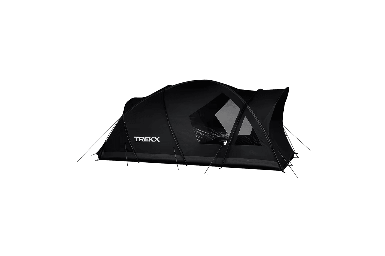
Stormridge 3 Tent
The structure that makes wild camping under allemannsretten viable rather than merely legal in Lofoten's weather
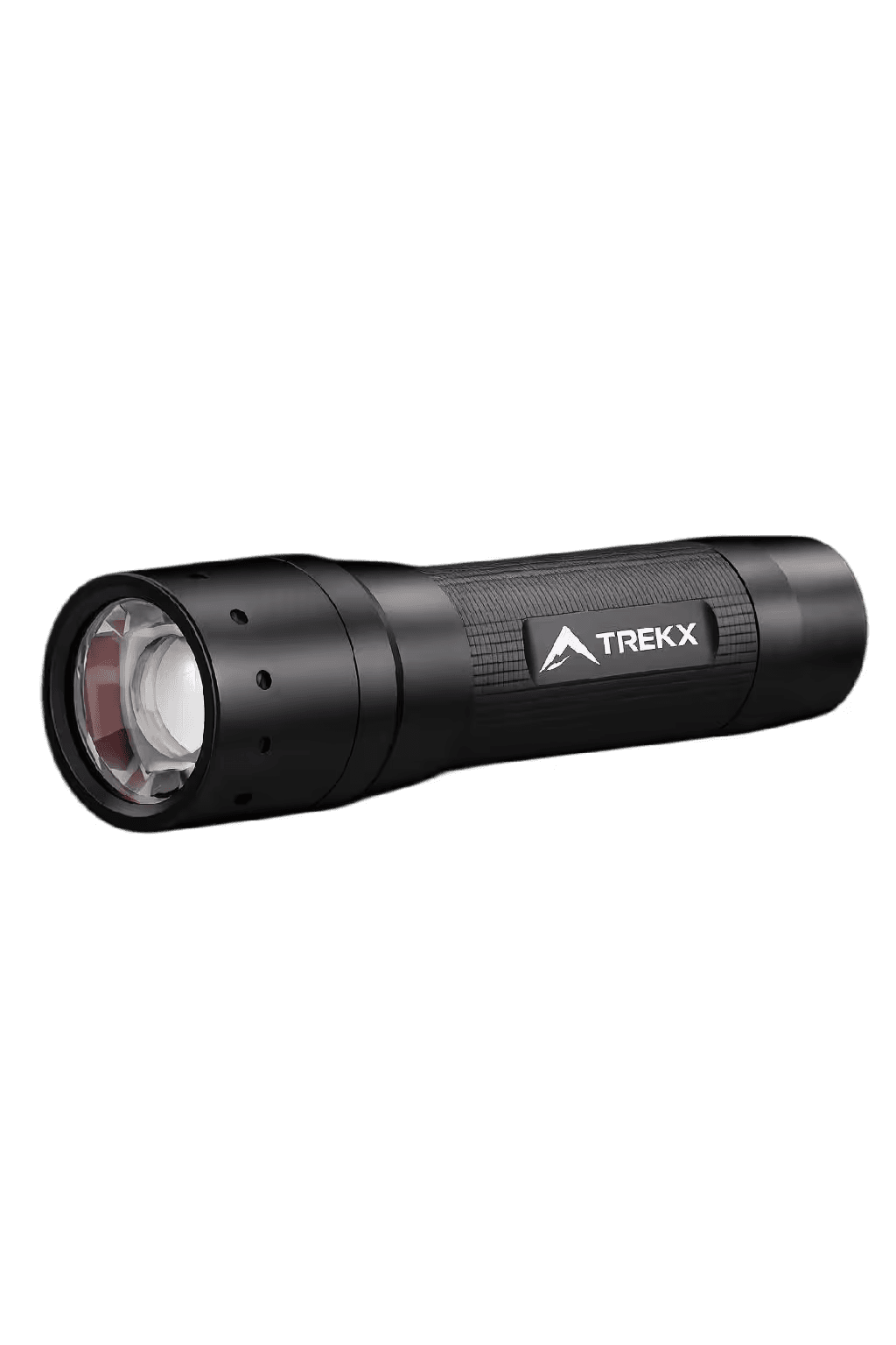
PeakBeam Torch
Redundant in the midnight sun at 11:00pm and essential at 3:00am in the dimmest point of the Arctic summer light cycle
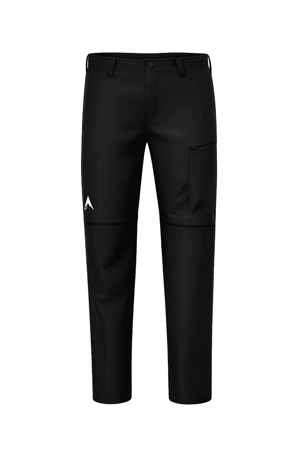
SummitTraverse Pants
The single layer that covers the full movement and temperature range of four days of Lofoten terrain

Northcrest Beanie
Compresses to hip-pocket size and deploys at every saddle, ridge, and evening camp where coastal wind at altitude drops the temperature