The wind in Patagonia is not weather. It is terrain. It arrives without the warning systems that wind elsewhere provides — no darkening sky, no pressure drop, no preliminary gust — and it arrives at a velocity that changes the physics of walking. At full strength on the exposed sections above Lago Grey, it is not possible to move forward against it. The correct response is to stop, turn sideways, plant the poles, and wait. Trekkers who have spent years in the Alps or the Himalayas describe Patagonian wind as categorically different from mountain wind elsewhere — not stronger necessarily, but more sustained, more lateral, and more willing to remove from the trail anyone who treats it as a condition to push through rather than a force to negotiate with.
The W Trek in Torres del Paine National Park covers approximately 80 kilometers across five days, connecting the three signature viewpoints of the park — the Torres themselves, the Valle del Francés, and the Grey Glacier — in a route that has become one of the most celebrated multi-day treks in the world for reasons that justify the reputation entirely. This is not a technical route. There is no climbing, no glacier travel, no navigation in the Alpine sense. What it requires instead is physical consistency, complete weather preparation, and the specific mental adjustment of accepting that the schedule belongs to the wind more than to the trekker.
01The Planning Gap
Most Patagonia trekking failures are planning failures rather than physical ones. The logistics here are more layered than any other route in this guide series, and they require resolution months before arrival — not weeks.
Permits & Campsites
CONAF, Chile's national park authority, manages all camping within Torres del Paine under a reservation system that operates at full capacity throughout the October–November season. Campsites on the W route — Chileno, Francés, Pehoe, Grey — must be reserved at pasesparques.cl the moment the booking window opens, typically August for the following November season. The park's private operator campsites — managed by Vertice Patagonia and Fantastico Sur — open earlier and at higher prices, and serve as the backup system when CONAF sites have sold out.
The W Trek camping versus refugio decision also requires early commitment. Refugio accommodation — bunk beds, shared bathroom, dinner and breakfast included — runs approximately $120–180 per person per night through Fantastico Sur and Vertice. Camping — tent pitch only, shared facilities — runs approximately $20–40 per site. For this guide, the camping route is the correct choice: a refugio-based W Trek is a different experience from a camping one, more comfortable and considerably less honest about what the park actually is. The wind at 2:00 am through the tent fabric teaches something about Patagonia that a bunk bed cannot.
Getting to Puerto Natales
The gateway town for Torres del Paine is Puerto Natales — a small city of 20,000 on the Última Esperanza fjord, 112 kilometers south of the park entrance. The standard international routing:
- Santiago to Punta Arenas — LATAM or Sky Airline direct, approximately 3 hours 15 minutes
- Punta Arenas to Puerto Natales — 3-hour bus via Bus Sur or Buses Fernandez, CLP $6,000–8,000
- Puerto Natales to park entrance — daily bus service from the town terminal, approximately 2 hours. Book through Recorrido
Spend one full day in Puerto Natales before entering the park. The town contains everything needed for final gear checks, food resupply, and the specific local knowledge — current wind forecasts, trail condition reports, water source updates — that only the gear shops and hostel staff carry reliably. Erratic Rock Hostel runs a nightly trekker briefing at 3:00 pm that covers current conditions on the W. Attend it without exception.
Gas canisters for the SummitBoil Stove System cannot be transported by air. Purchase them in Puerto Natales at Baquedano Outdoors or any of the gear shops on Baquedano Street. Standard 230g threaded canisters are available, and stock is reliable during the October–November season. One 230g canister covers approximately 4–5 days of cooking for two people.
02Day One: Park Entrance to Chileno
Distance: 11km | Elevation gain: 730m | Estimated time: 5–6 hours
The first day ends beneath the Torres themselves — three granite towers of Precambrian rock rising 2,500 meters from a glacial cirque, their geometry so improbable that the first sighting, cresting the moraine ridge above Lago Torres, produces a physical response that most trekkers describe as disbelief before anything else. The approach does not reveal them gradually. It withholds them entirely and then presents them complete.
Amarga to Chileno
The trail from the Laguna Amarga park entrance follows the Rio Ascencio through lenga beech forest for 7 kilometers before beginning the sustained climb to the Chileno campsite at 730 meters. The forest section is sheltered and deceptive — warm, birdsong-filled, the path wide and well-graded — and produces a false confidence about the park's conditions that the ridge above Chileno immediately corrects. The wind above the treeline arrives at the forest edge as a sound before it becomes a force. Stop here and add the wind layer before emerging. It will not be convenient to do it on the exposed ground above.
The Altitude Trek Pack — or equivalent 50L+ pack — carries the full camping system for five days. Day one is always the heaviest: five days of food, the full tent system, cooking kit, and sleeping system all present simultaneously before any calories have been consumed or any resupply reached. The hip belt load matters on the 730-meter climb more than on any subsequent day. Set it correctly at the trailhead, not at the halfway point when the discomfort becomes impossible to ignore.
Mirador Las Torres
From the Chileno campsite, a 2.5-kilometer path continues to the Mirador Las Torres at the base of the cirque — a 45-minute walk on an improving trail that the majority of trekkers complete in the late afternoon after dropping packs at camp. The mirador sits at the edge of a glacial lake of milky turquoise, the Torres rising directly from the opposite shore, their summits frequently in cloud and occasionally, briefly, fully clear. The light on the east face of the Torres in late afternoon — orange granite against blue sky on the rare clear days of early November — is the image that defines Torres del Paine internationally. It is available for approximately 20 minutes before the sun drops behind the western ridge. Be at the lake by 4:30 pm.
Open fires are prohibited throughout Torres del Paine National Park without exception. A wildfire in 2011 burned 176 square kilometers of the park — approximately 17% of its total area — after an unattended campfire. The SummitBoil Stove System is the only compliant cooking method. Any open flame, including candles inside tents, is subject to immediate park expulsion and significant fines. CONAF rangers patrol campsites specifically for fire compliance.
03Day Two: Chileno to Francés via Cuernos
Distance: 16km | Elevation change: +400m / -600m | Estimated time: 6–7 hours
The second day traverses the central section of the W along the northern shore of Lago Nordenskjöld — a 14-kilometer lake of extraordinary colour whose northern shore carries the trail between the Torres sector and the Francés valley. The lake surface in the wind is not calm. It is white-capped and lateral, the spray reaching the trail in gusts, the water a deep, cold blue that makes the surrounding desert-brown of the spring hillside appear even more extreme by contrast.
Wind Management
The lakeside traverse is where Patagonian wind becomes the primary tactical consideration rather than a background condition. The gusts here are channeled by the valley geometry and arrive from the west-southwest with enough force to move an unbraced trekker sideways on exposed sections. Lean into it? Impossible to sustain. Stop and wait? Sometimes the only option. The correct posture is a slight forward lean with poles planted wide — the Altitude Carbon Poles providing the lateral stability that allows forward movement to resume after a gust peaks. On fully exposed headland sections where the trail rounds a promontory, move in the lower gust windows: 30 seconds of wind, 10 seconds of relative calm, move decisively in the calm, replant before the next gust arrives.
The Cuernos
The Cuernos del Paine — the horned secondary peaks above Lago Nordenskjöld, their summits capped with black sedimentary rock contrasting against pale granite beneath — are the defining visual of the lakeside traverse. The geology that produced them is the same process that produced the Torres, but the result is formally opposite: where the Torres are pure monolithic columns, the Cuernos are complex and layered, the dark caps reading as crowns above the paler rock. The light on them in morning cloud and afternoon clearance shifts their character completely — it is worth pausing at the viewpoints east of the Cuernos hut even if the schedule is already running against the wind.
Francés Campsite
The Campamento Francés sits at the entrance to the Valle del Francés at the western end of Lago Nordenskjöld. Arrive with enough daylight to pitch correctly — the Stormridge 3 Tent's guy-wire system is the reason it survives Patagonian nights, and a rushed pitch in failing light with tired hands is the version most likely to fail at 3:00 am when the wind peaks. Orient the tent with the narrowest profile facing southwest. Stake all guy wires. Double-check every stake. The sound of a tent failing in Patagonian wind at 2:00 am is a specific kind of education in the difference between a correctly pitched tent and an approximately pitched one.
The SummitBoil Stove System and TrailForge Cook Kit work together for the evening meal: boil water first for drinks, then use the residual heat for the cook bag, and manage the gas carefully. The wind at a Patagonian campsite makes stove efficiency a real consideration rather than an abstract one — the SummitBoil's windscreen integration is the feature that prevents the 3-minute boil from becoming a 12-minute one in a gust.
The TerraRest Sleeping Pad is the layer between the cold ground and the AlpineLite Sleeping Bag that the system depends on. At Francés in October, ground temperature drops to near-zero by midnight regardless of air temperature. An R-value below 3.5 loses the sleeping bag's rated performance entirely by 3:00 am. The TerraRest's insulation keeps the system honest through a full Patagonian night.
The Francés valley day-walk to Mirador Británico — 9 kilometers return from the campsite, gaining 600 meters — is the optional half-day extension on day three's schedule. If the group is moving well and the weather allows, this viewpoint above the valley is the most dramatic interior view on the W. Leave packs at camp and travel light.
04Day Three: Valle del Francés
Distance: 9km valley walk + 4km camp relocation | Elevation gain: 600m to Británico | Estimated time: 6–7 hours
The Valle del Francés is the vertical heart of the W Trek. Where the Torres are a single overwhelming presence, and the lake traverse is horizontal endurance, the Francés valley is a contained drama — glacier above, hanging seracs visible from the valley floor, rockfall audible every 20–30 minutes from the ice faces on the western wall. The path from Campamento Francés climbs through lenga beech forest into open alpine meadow before the glaciated amphitheatre opens above. The Mirador Británico at 900 meters delivers the full valley — glacier, towers, lake below — in a single frame that no other viewpoint on the W replicates.
Glacier Sound
The glaciers above Valle del Francés calve continuously in spring. The sound of ice release from the hanging seracs — a crack followed by a low rumble that travels down the valley walls and arrives at the trail several seconds after the visual event — is one of the more unexpected sensory experiences on the route. It is not dangerous at the trail level. It is simply a reminder that the scale of the landscape includes timelines that walking through it does not.
Relocate to Campamento Pehoe after returning from Británico — a 4-kilometer flat walk west along the Lago Skottsberg shore to the campsite above Lago Pehoe, with the full Cuernos visible across the water on the final approach.
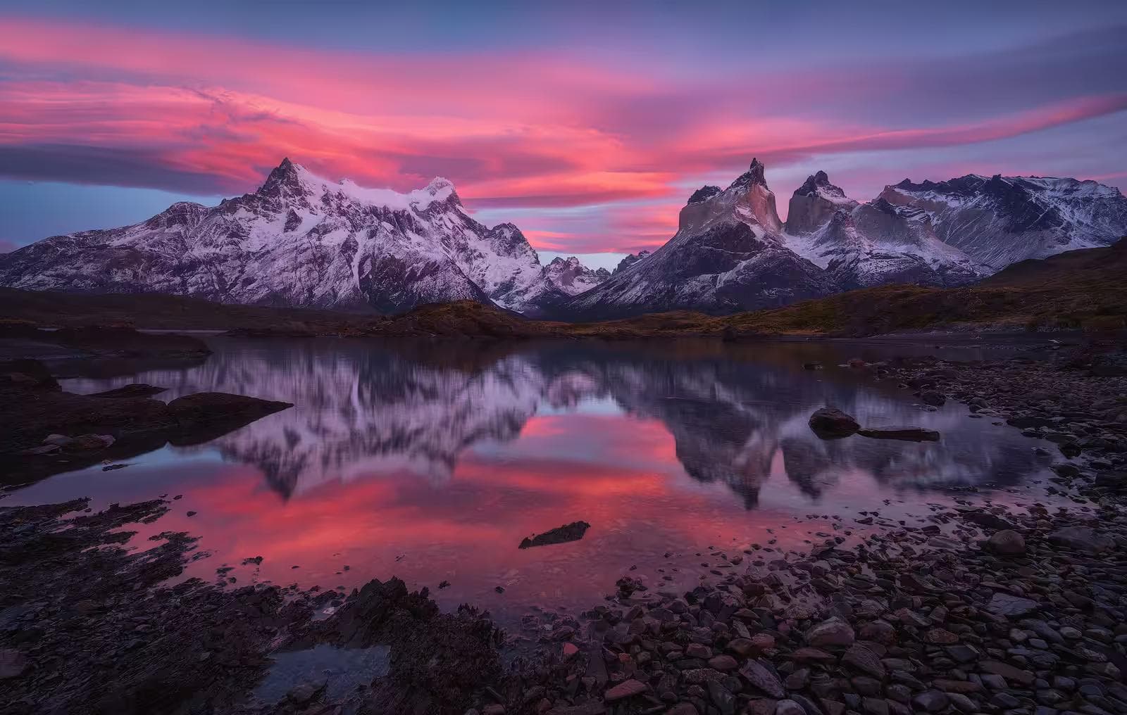
05Day Four: Pehoe to Grey Glacier
Distance: 11km | Elevation change: +200m / -200m | Estimated time: 4–5 hours
The fourth day moves west to the Grey Glacier — a 270-square-kilometer ice field descending from the Southern Patagonian Ice Field to the northern end of Lago Grey, the glacier face calving blue icebergs into the lake in volumes that make the lakeside approach progressively more surreal as distance closes. The icebergs in Lago Grey are not the scale of polar icebergs — they are human-scaled, some the size of a car, some the size of a house, all a shade of blue that has no equivalent in non-glacial contexts.
Suspension Bridges
The path from Pehoe to Grey crosses two suspension bridges above the Rio Grey gorge — narrow, bouncing, exposed to full valley wind — that require crossing one person at a time. The sensation of a suspension bridge in Patagonian crosswind is one that the body resolves as alarming before the intellect catches up with the structural reality. Cross deliberately, one hand on the cable, poles vertical rather than extended, and do not stop in the middle to photograph the gorge below. There will be time for that at the far bank.
Grey Campsite
Campamento Grey sits above the northern shore of Lago Grey with the glacier face directly visible across the water. This is the most remote campsite on the W and the most exposed — the wind off the Southern Ice Field arrives at Grey with nothing between the glacier and the tent. The pitch protocol from Francés applies here with doubled attention. Stakes through the tent's guy loops and into the ground — not weighted, staked — every single one.
06Day Five: Grey to Pudeto & Exit
Distance: 22km or catamaran shortcut | Estimated time: 7–8 hours walking or 2 hours with a boat
The final day completes the W by returning east from Grey to the Pudeto catamaran dock on Lago Pehoe, either on foot — retracing the Grey and Pehoe sections in reverse, 22 kilometers — or via the Hielos Patagónicos catamaran from Grey dock to Pudeto, a 30-minute crossing that eliminates the retracing. For most trekkers on day five, the catamaran is the correct decision — the return walk covers nothing new, the legs are at their most depleted, and the crossing itself, through the iceberg field on Lago Grey, provides a final perspective on the landscape that the walking route does not. Book the catamaran crossing in advance from Puerto Natales; it fills with W trekkers daily throughout October and November.
From Pudeto, a bus returns to the park entrance and onward to Puerto Natales. One night in Puerto Natales before the return flights allows the pack to dry, the gear to be sorted, and dinner at Afrigonia — the best restaurant in Puerto Natales — to provide a conclusion to five days of dehydrated meals and wind-sheltered cooking that the body will receive as disproportionately meaningful.
Weather in Torres del Paine can force trail closures, campsite evacuations, and catamaran cancellations without advance notice. Build a one-day buffer into the return travel schedule before any onward flight from Punta Arenas. Missing a connection because the catamaran was cancelled and the alternative route added six hours to day five is a situation that a single buffer day entirely prevents, and that no amount of tight scheduling survives.
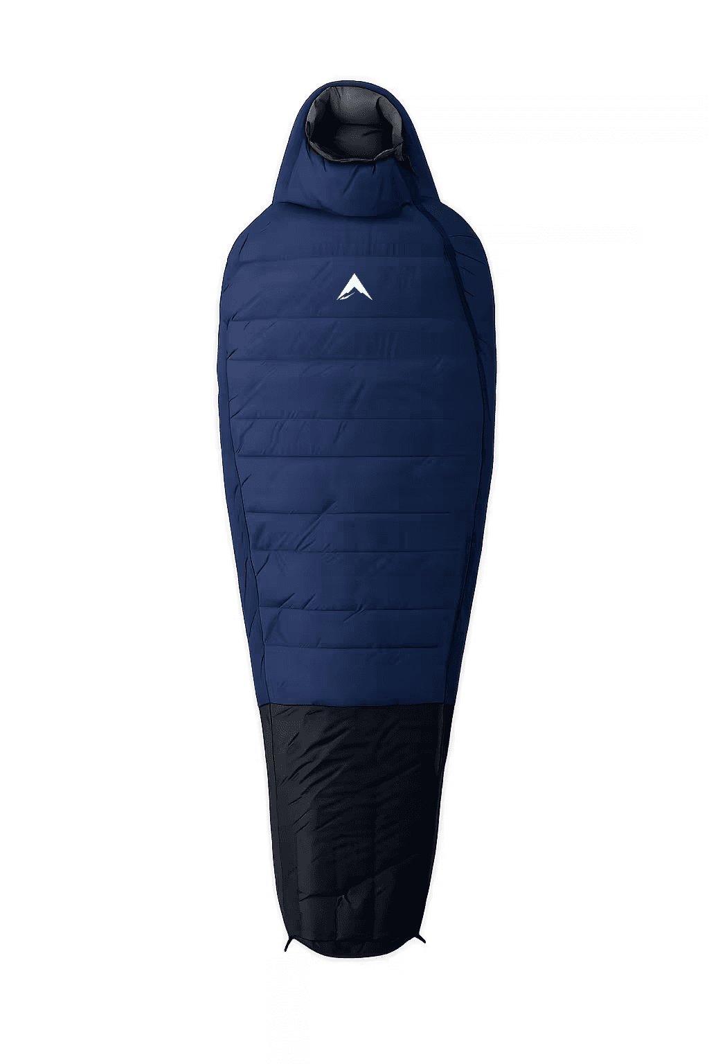
AlpineLite Sleeping Bag
Rated for the near-zero ground temperatures that Patagonian campsites reach by midnight
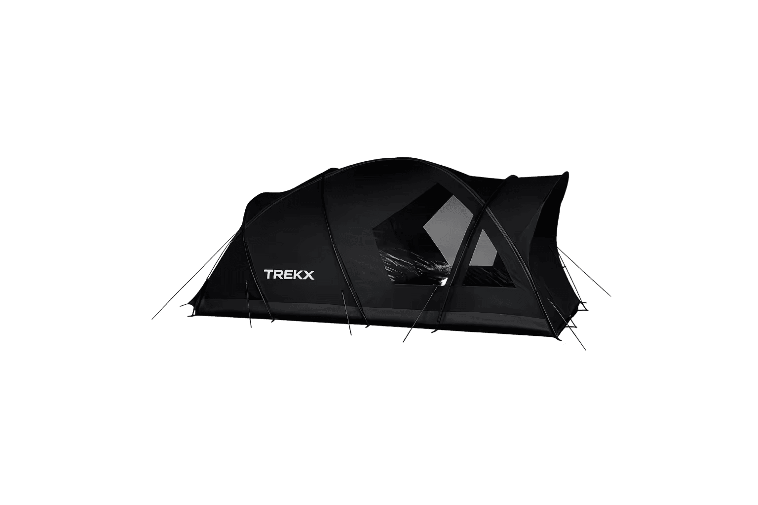
Stormridge 3 Tent
The shelter system that stands between a correctly pitched camp and a 2:00am equipment failure in sustained Patagonian wind
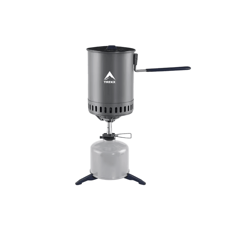
SummitBoil Stove System
The cooking system the park's fire regulations require where open fire is prohibited and unshielded flames are extinguished by the wind before they reach temperature
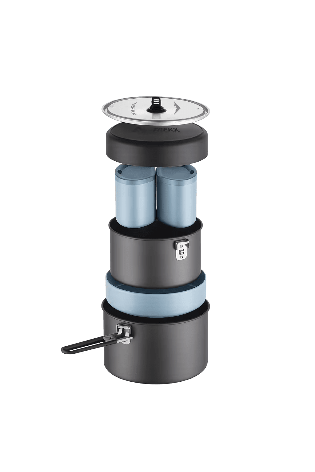
TrailForge Cook Kit
Handles five days of hot meals and drinks in a compact, packable system

TerraRest Sleeping Pad
Insulates the sleeping system from near-zero ground temperature across five nights