The Laugavegur trail does not begin gently. The first hour out of Landmannalaugar climbs through a lava field so recent — geologically — that nothing has had time to grow on it yet. The surface is black and sharp and entirely indifferent to footfall. The rhyolite mountains above it are striped pink and sulphur-yellow from mineral cooling that happened at different rates, and the steam rising from geothermal vents at the field's edge is not atmospheric — it is simply the ground continuing to do what it has been doing for ten thousand years. By the time the lava field ends and the first ridge opens, the wind has already made itself known. Not as a problem, precisely, but as a presence. A reminder that the landscape here has its own logic, its own schedule, and no particular investment in yours.
The Laugavegur trail — 55 kilometers from Landmannalaugar south to Þórsmörk — is Iceland's most celebrated multi-day route and one of the most demanding beginner-to-intermediate transitions in European trekking. This guide covers it across three full days: not a rushed traverse, but a paced crossing that treats the route as a landscape to move through rather than a distance to complete. The difference between those two approaches is the difference between a physical achievement and an experience that changes how you understand weather, terrain, and your own capability in genuinely remote conditions.
01Before the Trail
The Laugavegur requires more pre-trip preparation than almost any other route in this guide series. Three non-negotiable items before departure:
- Hut reservations — the Ferðafélag Íslands (FÍ) mountain huts at Hrafntinnusker, Álftavatn, and Emstrur must be booked months ahead. July and August dates open in January and sell out within days. Book the morning reservations open. Do not rely on tent-only spots as a backup plan — the plateau weather makes exposed camping without hut access genuinely dangerous in storm conditions.
- 4WD transport to Landmannalaugar — the F208 highland road involves unbridged river crossings. Either join a Reykjavík Excursions highland bus from Reykjavík or Hella, or rent a qualified 4WD and check the crossing conditions on the road.is the morning of travel. Standard rental cars are not insured for F-roads, and the crossings will damage them.
- Weather window — check vedur.is and safetravel.is for the three-day forecast before committing to a start date. The Laugavegur plateau is genuinely dangerous in sustained winds above 25 m/s. Build a one-day weather buffer into the wider trip itinerary if possible.
Register Before You Walk
Safetravel.is operates Iceland's official trekker registration system. Register the route, the planned dates, and the emergency contact before leaving Landmannalaugar. This is not bureaucracy. It is the mechanism that dispatches search and rescue if the plan fails. Complete it without exception.
The Laugavegur plateau has no mobile signal for the majority of its length. Between Hrafntinnusker and Álftavatn, and between Emstrur and Þórsmörk, connectivity is effectively zero. An emergency cannot be communicated from most of the route without a satellite communicator. If carrying one — a Garmin or a GPS device — register the device's emergency number with your home contact before departure.
02Day One: Landmannalaugar to Hrafntinnusker
Distance: 12km | Elevation gain: 520m | Estimated time: 5–6 hours
The first day is the hardest in terms of terrain and the most extraordinary in terms of landscape. From the Landmannalaugar hut area, the trail climbs immediately through the lava field and onto the rhyolite ridge above, gaining 400 meters in the first 4 kilometers on a path that alternates between firm volcanic rock and loose scree that shifts underfoot without warning. The colour change as the elevation rises is one of the more disorienting sensory experiences in Icelandic trekking — yellow gives way to rust, then to dark obsidian, then to a pale grey pumice that looks like snow from a distance and compresses like wet sand underfoot.
Rhyolite Ridge
The Altitude Carbon Poles earn their role immediately in this section. The scree above the lava field is the exact terrain where pole contact transforms a tentative ascent into a controlled one — not by reducing the effort required, but by distributing weight across four points instead of two on surfaces where the footing cannot be assumed stable between steps. On loose volcanic scree at 900 meters in a crosswind, the poles are not an accessory. They are the mechanism that keeps the body upright when the ground decides not to cooperate. Adjust the wrist strap tension before the lava field ends — it will not be comfortable to stop and do it on the ridge above.
Geothermal Fields
At approximately the 6-kilometer mark, the path crosses the Storihver geothermal field — a series of boiling springs, mud pots, and steam vents spread across a 500-meter section of the ridge. The ground here is warm underfoot through boot soles. The steam smells of sulphur. The colour of the mineral deposits around the vent edges runs from white through orange to a deep brick red. Stay on the marked trail — the surface between vents is unstable in ways that are not always visible, and the water in the springs reaches boiling point at this altitude. The yellow marker posts are not suggestions.
The approach to Hrafntinnusker hut crosses a permanent snowfield that persists through most of July. The snow is compact and walkable without crampons in normal summer conditions, but the poles provide critical balance on the descent off the snowfield's far edge where the surface transitions abruptly to wet volcanic gravel.
Hrafntinnusker Hut
The Hrafntinnusker mountain hut sits at 1,100 meters in an exposed position on the plateau — the most isolated structure on the entire route, surrounded by obsidian outcrops and the permanent snowfields of the Torfajökull caldera. Wind here is structural. The hut walls shake in gusts that feel designed rather than accidental. Change into dry layers immediately on arrival. The Altitude Trek Pack's internal organization matters here — wet outer layers go into the StormVault Dry Bag before anything else is unpacked, keeping the sleeping system and spare insulation dry regardless of what the pack exterior absorbed during the crossing.
Dinner is whatever was carried from Landmannalaugar. The hut has gas rings and a common area, but no supplied food. The PureFlow Water Filter handles the snowmelt stream 50 meters south of the hut — clear, cold, and free of treatment chemicals that bottled alternatives cannot avoid — producing drinking water that costs nothing and tastes of altitude in a way that is difficult to describe and easy to remember.
Hrafntinnusker hut sleeps 52 in tiered bunks. Earplugs are worth more than they weigh. Pack them in the lid pocket of the Altitude Trek Pack, where they are findable in darkness at 11:00 pm without waking the bunk above.
03Day Two: Hrafntinnusker to Álftavatn
Distance: 12km | Elevation loss: 560m | Estimated time: 4–5 hours
The second day descends from the plateau to the lake at Álftavatn — a transition that covers more terrain variety in 12 kilometers than most full-day routes achieve in twice the distance. Snowfield, volcanic desert, river crossing, green valley floor, lakeshore — each one arriving without warning, the landscape shifts completely every 90 minutes.
Snowfield Crossing
The first 3 kilometers from Hrafntinnusker cross a broad permanent snowfield in the Jökultungur area. In early July, the snow is deep, and the route is marked with orange poles spaced at visual distance from each other. In poor visibility — low cloud or blowing snow — the poles become the entire navigation system. Do not leave the pole line under any circumstances. The snowfield is featureless in low cloud, and the plateau above it drops steeply to the east. Follow the markers, move steadily, and do not stop on the exposed snowfield longer than necessary.
Volcanic Desert
Below the snowfield, the terrain transitions to a black volcanic desert — a flat, wind-scoured plain of ash and pumice that extends for 2 kilometers with no vegetation, no shelter, and no visual reference beyond the trail markers. This section, more than any other on the route, produces the understanding that Iceland is not performing wilderness. It simply is wilderness, without apology or mitigation. The wind across the desert has nothing to interrupt it. The Stormveil Shell Jacket is the layer that makes crossing it a neutral experience rather than a punishing one — hood cinched, chest zip fully sealed, the jacket holding its structure against sustained lateral wind in a way that a non-technical layer cannot maintain.
Álftavatn River Crossing
The approach to Álftavatn involves two glacial river crossings — unbridged, cold, and variable in depth depending on recent snowmelt. The standard crossing points are marked, but the crossing depth changes daily and requires assessment on arrival. Thigh-deep crossings are common in July. Knee-deep crossings are the best case. Waist-deep crossings mean finding an alternative line upstream.
Crossing protocol:
- Remove gaiters and pack the lower legs of trekking pants into the boot — it sounds counterintuitive and is correct
- Loosen the hip belt and sternum strap of the Altitude Trek Pack — in case a fall requires rapid pack removal in the current
- Use both Altitude Carbon Poles as a tripod with the body — two poles and two feet create four contact points in moving water
- Cross diagonally downstream, angled slightly with the current rather than against it
- Do not cross alone — if other trekkers are present, cross as a group with physical contact between walkers
The StormVault Dry Bag is the reason electronics, sleeping bags, and down layers survive this crossing regardless of outcome. A dropped pack in a glacial river without waterproof internal organization is a three-day problem compressed into three seconds. The dry bag is not a contingency measure. It is the standard packing configuration from day one.
Álftavatn
The lake at Álftavatn appears suddenly at the valley's edge — a wide, shallow body of water the colour of pale steel, the Tindfjallajökull glacier visible above its southern shore, the surrounding moorland running right to the waterline without any transition zone. The Álftavatn hut sits above the eastern shore and is the most comfortable on the route — a newer structure with improved drainage and a wider common area. Arrive early enough to dry gear on the outdoor racks before the evening wind arrives.
The PureFlow Water Filter draws directly from the lake here — Álftavatn's water is glacier-fed and visually clear, but glacial sediment and upstream geothermal contamination make filtration non-negotiable regardless of appearance. Filter two full bottles before dinner and two before sleep.
Glacial river crossings on the Laugavegur are responsible for the majority of serious incidents on the route annually. If the crossing depth appears above thigh height, or if the current is strong enough to make stable footing difficult to establish, do not cross. Wait for other trekkers. Ask the hut warden at Hrafntinnusker for the current crossing report before departing. The schedule is not worth the risk.
04Day Three: Álftavatn to Þórsmörk
Distance: 26km | Elevation change: +400m / -600m | Estimated time: 8–10 hours
The final day is long. It is the longest day on the Laugavegur by a significant margin, and it requires an early start — 6:30 am from the hut at the latest — to complete in daylight with an adequate margin for the weather changes that the southern section reliably produces. Do not underestimate day three because days one and two felt manageable. The terrain is varied, the distance is real, and the last 10 kilometers through Þórsmörk's birch woodland — beautiful, confusing in poor visibility, and longer than the map suggests — arrives when the legs are already asking questions.
Emstrur Crossing
The middle section of day three passes through Emstrur — a canyon area above the Markarfljót river, black basalt walls dropping 200 meters to a glacial river below — at approximately the 16-kilometer mark. The canyon views here are the most dramatic of the entire route: the river is a pale grey-green below the basalt, the far wall vertical and scored with erosion channels, the whole structure recent enough that the geology feels provisional rather than permanent.
The Emstrur hut provides the final water and toilet facilities before Þórsmörk. Stop here regardless of pace. Refill both bottles through the PureFlow from the hut's source stream. Eat something substantial. The next 10 kilometers through the birch forest to Þórsmörk have no facilities, no reliable signal, and no shelter beyond the trees themselves.
Into Þórsmörk
The descent into Þórsmörk — through a scrub birch forest that grows progressively denser as elevation drops — marks the end of the volcanic plateau and the beginning of something genuinely different in character. The sound of wind on open ash becomes the sound of leaves. The smell of sulphur becomes the smell of earth. The temperature rises 4 degrees in 20 minutes of descent. The Altitude Trek Pack's hip belt will be felt in the hips by this point in a way it was not on day one — 26 kilometers of cumulative load registers differently at kilometer 26 than at kilometer 3. Adjust the fit on the descent and transfer weight back to the shoulders for the final flat section through the valley.
The Volcano Huts at Þórsmörk provide the endpoint. Hot shower. A meal that did not come out of a dry bag. A chair that is not a bunk. Three days of volcanic wind and glacial crossings and 50 kilometers of Icelandic highland decompress in approximately the time it takes for the shower water to run hot.
Getting Out
The Þórsmörk valley has no road access for standard vehicles. Exit options:
- Reykjavík Excursions bus from Þórsmörk to Reykjavík — runs twice daily in summer, approximately 3 hours. Book in advance.
- Fimmvörðuháls trail onward to Skógar — an additional day's walking across the high pass between Eyjafjallajökull and Mýrdalsjökull, connecting to the south coast. For those with legs remaining and a fourth night available.
Book the Þórsmörk–Reykjavík bus seat at the same time as the hut reservations, months ahead. The bus is the only realistic exit without a second 4WD arranged at Þórsmörk, and it fills with the same hikers who booked the huts in January
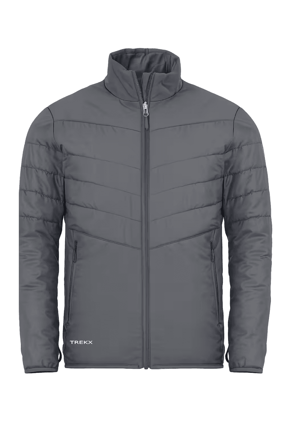
Stormveil Shell Jacket
worn through the volcanic desert crossing, the snowfield approach, and every exposed ridge section where sustained Highland wind makes an unprotected upper body a liability
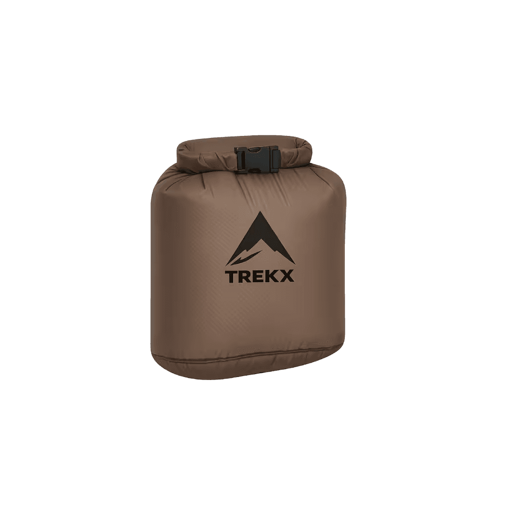
StormVault Dry Bag
Protects sleeping bag, electronics, and insulation layers through glacial river crossings and the sustained rain exposure that plateau camping produces
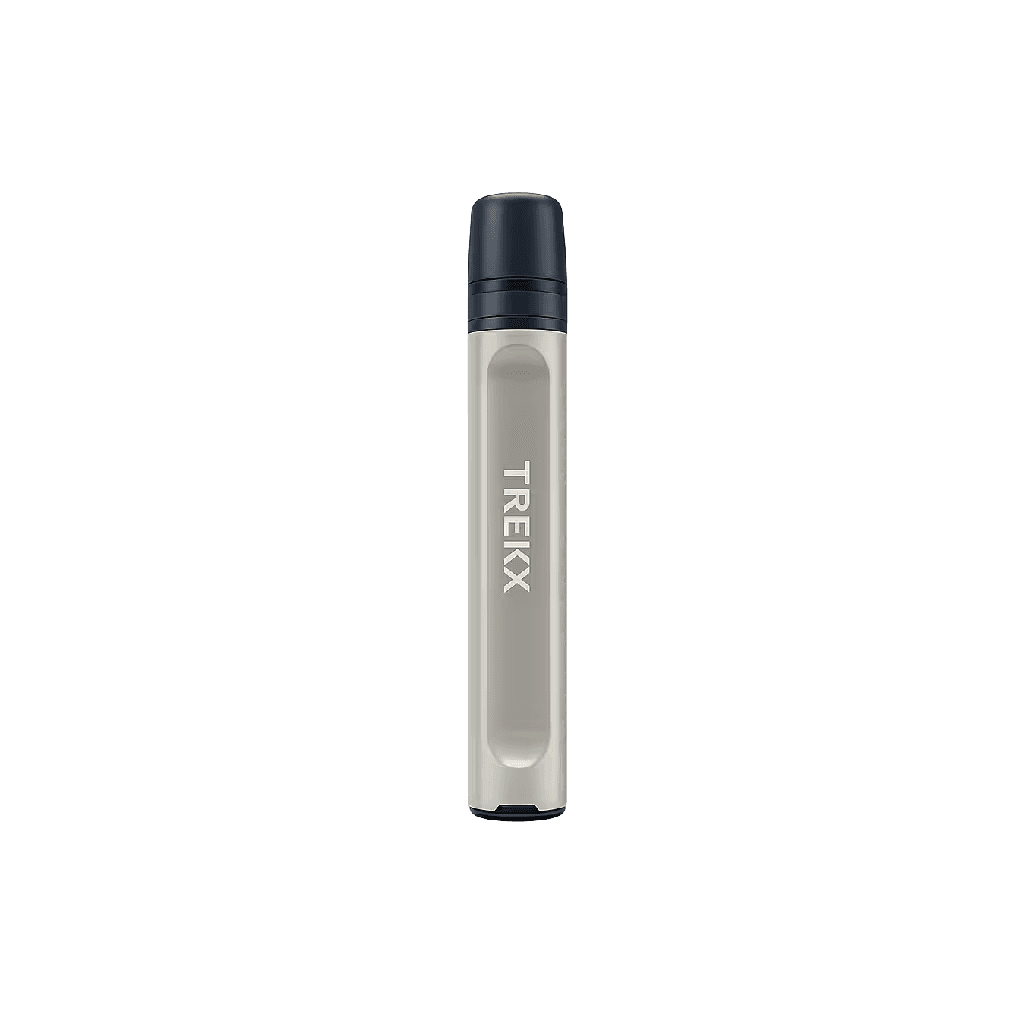
PureFlow Water Filter
Draws clean water from snowmelt streams and glacial lakes across days of remote travel where purchased water is unavailable and unfiltered glacial sources carry contamination
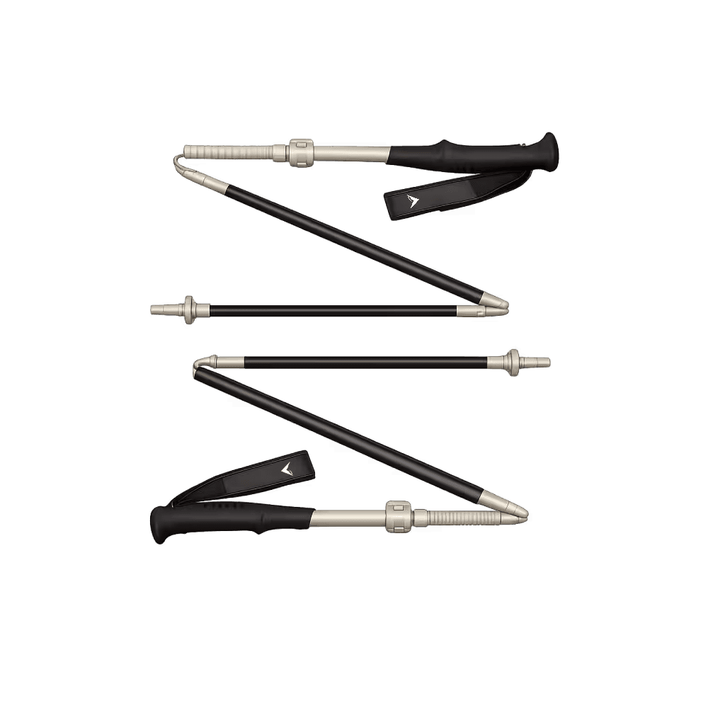
Altitude Carbon Poles
The load management system that keeps weight distributed correctly when the day extends to 10 hours and the terrain stops being predictable
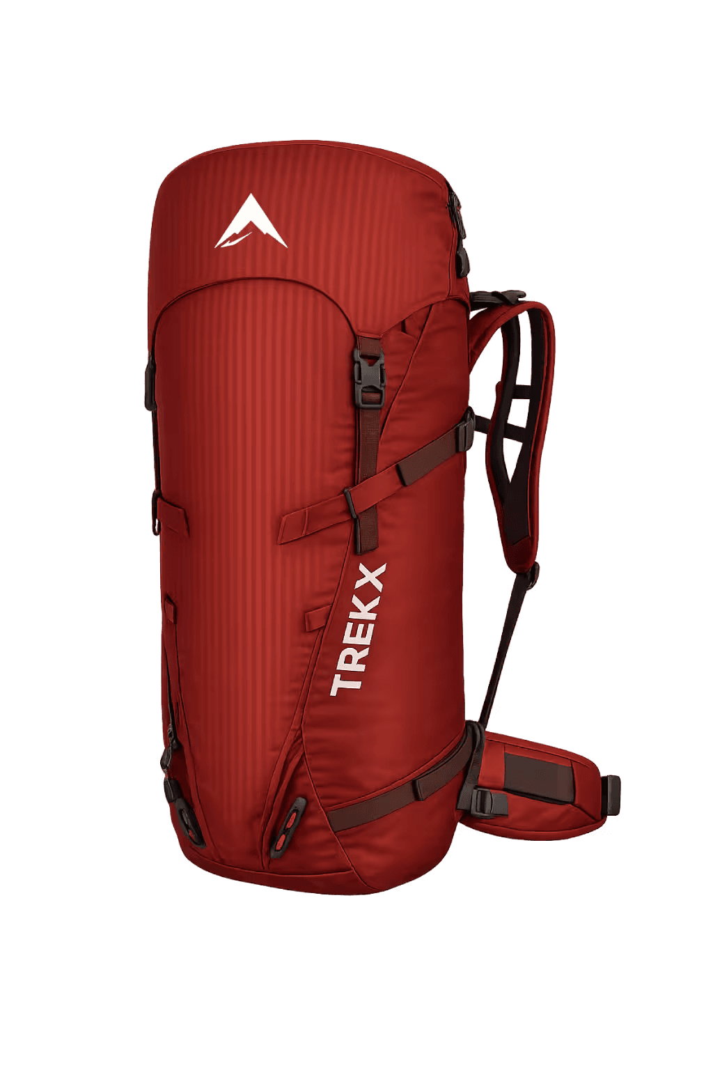
Altitude Trek Pack
Carries three days of food, camping gear, and technical layers across 50 kilometers of Highland terrain