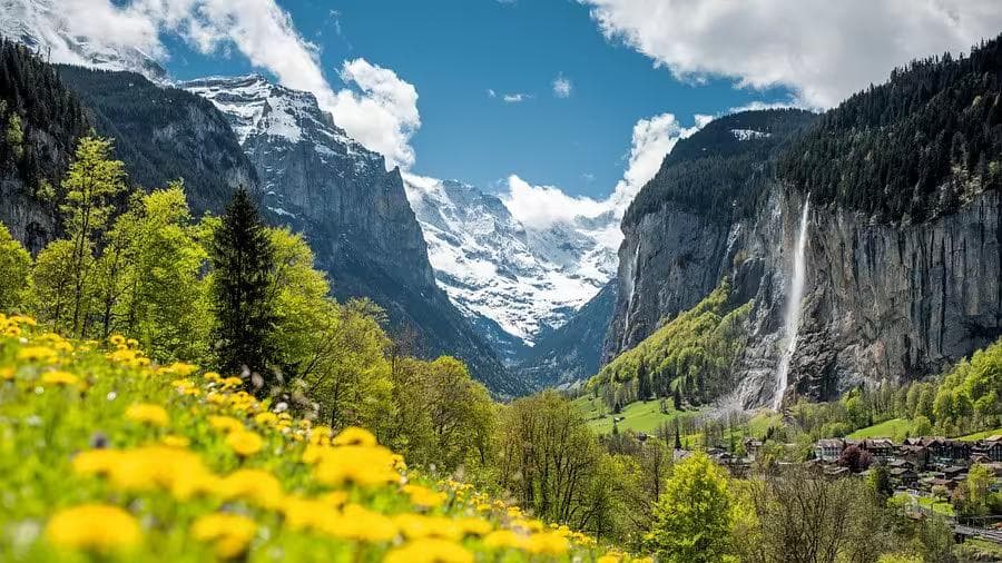
There is a moment on the path above Grindelwald — somewhere between the treeline and the first open alp, the Eiger's north face filling the entire northeastern sky — when the landscape stops being scenery and becomes something more immediate. The scale of it is not photogenic in the ordinary sense. It is too large for that. The glaciers are too close, the walls too vertical, the colour of the lake below too specific a shade of turquoise to register as a real thing rather than a composite. Switzerland does this consistently across the Bernese Oberland: it presents a version of the alpine world that looks like a postcard and then, once you are inside it and walking through it, reveals that the postcard was actually underselling it. Three days at moderate elevation, on paths that require no technical ability and reward every hour of walking with a view that most people will remember for years.
01The Bernese Oberland
The Bernese Oberland — the highland region south of Bern, anchored by the Eiger, Mönch, and Jungfrau massif — is the most concentrated area of beginner-accessible alpine scenery in Europe. The infrastructure supporting it is Swiss: precise, comfortable, and engineered to deliver non-technical walkers to high alpine environments that would otherwise require days of approach. The cogwheel railways, aerial gondolas, and mountain buses that serve the region are not concessions to comfort — they are the reason someone without alpine experience can stand at 2,100 meters on their second day in the country and look at a view that Himalayan trekkers specifically travel here to see.
Interlaken is the logical base. Sitting between two lakes — Thunersee to the west, Brienzersee to the east — it functions as the transport hub for the entire region and connects by train to Grindelwald, Lauterbrunnen, and Wengen in under 30 minutes. Accommodation runs from budget hostels to mid-range hotels; Hotel Interlaken and Backpackers Villa Sonnenhof both work well as three-night bases. The Swiss Travel Pass covers all standard rail and bus connections within the region and is worth purchasing before departure for any visit longer than two days.
Getting There
- From Zurich Airport — direct InterCity train to Interlaken Ost, approximately 2 hours. Book via SBB.
- From Geneva Airport — train to Bern, change to Interlaken, approximately 2 hours 15 minutes.
- From Basel — direct train to Interlaken West, approximately 1 hour 45 minutes.
The Swiss Travel Pass covers the full rail network, including the Jungfrau regional trains to Grindelwald and Lauterbrunnen. Purchase it online before arrival. For three days of intensive mountain transport, it pays for itself within the first day.
02Day One: Grindelwald & First
The first day acclimates to scale. Grindelwald — 35 minutes by train from Interlaken — sits in a broad valley directly below the Eiger's north face and is the most dramatically positioned village in the Bernese Oberland. From the main street, the north face rises 1,800 meters in a single unbroken wall directly above the church spire — a proximity that makes the ordinary scale of a Swiss village feel slightly wrong, as though the mountain has moved closer than it should be allowed to.
First Mountain Gondola
The First gondola lifts from the village edge to 2,168 meters in 25 minutes across four stations, each one emerging above the previous treeline into more open alpine terrain. From the First summit station, the Bachalpsee trail — a 3-kilometer path to a twin glacial lake at 2,265 meters — is the first walk of the itinerary and the correct introduction to what the Bernese Oberland does to expectations.
Bachalpsee
The path from First to Bachalpsee gains 100 meters of elevation across a wide alpine meadow — in July, the meadow carries gentian, alpine rose, and the specific yellow of arnica in quantities that make the path difficult to walk without stopping — before arriving at the lake shore. The Eiger, Mönch, and Jungfrau are reflected in the western lake with a clarity that makes the composition almost too obvious. Every photographer who arrives here makes the same image and then stands looking at the actual view for longer than they intended.
The TrailStart Trekking Poles are worth deploying from the First station rather than the valley. The meadow path is gentle, but the return from Bachalpsee descends a rougher trail via Grindelwald Grund — 900 meters of elevation loss on a rocky, steep-at-times path that the poles convert from a knee-intensive descent into a controlled and comfortable one. For a first alpine day on terrain that is new underfoot, the poles provide balance and confidence that matters disproportionately on the way down.
Grindelwald Evening
Return to Grindelwald by late afternoon. The village's main street contains enough restaurant options for a genuine choice — Restaurant Onkel Tom's Hütte for fondue in a wooden interior that has not changed since 1976, or the Glacier Restaurant for something lighter on a terrace facing the Eiger. The Ridgeway Outdoor Jacket is the layer that makes an outdoor terrace dinner viable at Grindelwald's elevation in July — by 7:00 pm the valley air drops quickly, and the jacket's warmth-without-bulk makes the difference between staying outside through the meal or retreating indoors before dessert.
The First Cliff Walk — a steel walkway cantilevered over the cliff face at the First summit station — is open without extra charge and takes 20 minutes. Do it before the Bachalpsee walk while the morning light is still low and the Eiger's north face is in full direct sun.
03Day Two: Lauterbrunnen & Mürren
The second day crosses to the western arm of the Oberland. Lauterbrunnen — 20 minutes by train from Interlaken — sits in a valley so vertical that 72 waterfalls descend from the plateau above it, the most dramatic of which, Staubbachfall, drops 297 meters in a free fall from the cliff directly above the village. The sound of the valley in early morning, before the first trains arrive, is entirely water — a low continuous presence from every direction, the individual falls distinguishable by proximity and angle.
The Valley Walk
The Lauterbrunnen Valley walk — 5 kilometers along the flat valley floor from the village south to the Trümmelbach Falls — is the morning's walk. The path runs through a wildflower meadow beside the Weisse Lütschine river, the waterfalls visible on the cliff face above at intervals throughout. Trümmelbach itself is a series of 10 glacier-fed waterfalls thundering through a narrow gorge inside the cliff face — accessible by tunnel lift and illuminated walkways — that process 20,000 liters of water per second during peak melt. The force of it inside the tunnel is physical. The walls vibrate. Conversation becomes impossible at the upper falls.
Mürren
From Lauterbrunnen, a cable car rises to Grütschalp, and a narrow-gauge railway continues to Mürren — a car-free village at 1,638 meters on the western cliff of the Lauterbrunnen valley, facing the Jungfrau massif directly. Mürren in clear weather is the view that Swiss tourism has been selling for 150 years: Eiger, Mönch, and Jungfrau in a single unbroken line across the southern horizon, the Lauterbrunnen valley 800 meters below, the village of wooden chalets undisturbed by any road. The walk from Mürren south to Gimmelwald — 3 kilometers, 200 meters descent, 45 minutes — is the afternoon's walk: through open alp, past working farms, and into a smaller, quieter village that Mürren's reputation has not yet reached.
Hydration at Altitude
The SummitFlow Bottle is the practical companion for both walks today — filled at the Lauterbrunnen station tap before the valley walk, refilled at the Mürren fountain before the Gimmelwald descent. Switzerland's mountain water is drinkable directly from the source in almost all cases, and carrying a full bottle from the valley rather than buying single-use plastic at every mountain stop is the habit that makes a three-day alpine itinerary both cheaper and simpler. The SummitFlow's wide mouth handles the angled drinking fountains that appear at every Swiss village square without requiring a specific pouring technique.
The cable car from Lauterbrunnen to Grütschalp and the Mürren railway both operate on seasonal timetables with last departures earlier than expected. Check the Jungfrau region transport schedule before leaving Lauterbrunnen for the return to Interlaken. Missing the last cable car means a taxi from Lauterbrunnen at Swiss rates, which is an expensive and avoidable conclusion to an otherwise excellent day
04Day Three: Schynige Platte & Lake Brienz
The final day uses elevation without effort. The Schynige Platte cogwheel railway departs from Wilderswil — one stop from Interlaken on the Grindelwald line — and climbs to 1,967 meters in 50 minutes on a rack railway built in 1893, the wooden carriages original, the gradient at points touching 25%. The journey itself is the first attraction: the valley dropping away below, the Brienzersee appearing between the fells as the railway curves around each successive bluff.
Alpine Garden & Ridge Walk
At the summit station, the Alpine Botanical Garden contains over 600 species of alpine plant arranged along the ridge — free to enter, extraordinary in June and July when the majority of species are in simultaneous bloom. The Schynige Platte to Faulhorn ridge walk — 8 kilometers one-way, gaining 400 meters to a summit at 2,681 meters — is the most rewarding full-day walk in the Oberland for a beginner with two days of walking already in the legs. The path follows the ridge east, the Brienzersee visible to the north and the full Jungfrau massif to the south throughout.
The Ridge in Practice
This is the day when the complete gear system works together:
- TrailStart Trekking Poles — the ridge path has several short technical sections on loose shale above 2,400 meters, where the poles provide lateral stability that the terrain genuinely requires
- SummitFlow Bottle — filled at the Schynige Platte station tap; no reliable water sources on the ridge above 2,200 meters until the Berghotel Faulhorn at the summit
- Ridgeway Outdoor Jacket — the ridge is exposed to northwestern wind throughout its length, and the temperature at 2,400 meters in July averages 8–12°C in wind; the jacket goes on at the first exposed section and stays on through the summit
The Berghotel Faulhorn at the summit has been operating since 1832 — the oldest mountain hotel in the Alps — and serves lunch on a terrace at 2,681 meters with a view that takes in both the Brienzersee and Thunersee simultaneously. Eating a bowl of soup at this altitude with both Swiss lakes visible below and the Jungfrau massif opposite is an experience that makes the 8-kilometer ridge walk feel like an extremely reasonable price of admission. Return to Schynige Platte via the same path, or descend to Grindelwald Grund via the longer Waldspitz path for a final valley approach that closes the three-day circuit where it began.
Final Evening
The train back to Interlaken from Wilderswil takes 8 minutes. The evening in Interlaken needs nothing ambitious — dinner at Restaurant Laterne on the Höheweg, a walk along the Aare river as the light fades over the Thunersee, and the specific quiet satisfaction of three days in the Swiss Alps on paths that required no technical skill and delivered everything they promised. The Bernese Oberland does not withhold its best scenery from beginners. It makes its best scenery the first thing beginners encounter, and trusts that the landscape will do the rest of the persuasion on its own
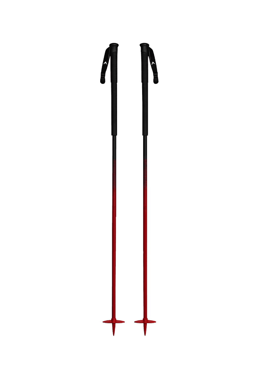
TrailStart Trekking Poles
Convert the Bachalpsee descent and Schynige Platte ridge shale sections from knee-intensive to controlled
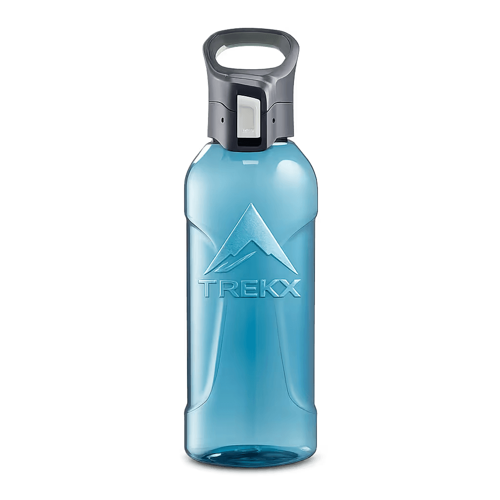
SummitFlow Bottle
Filled at village fountains before each day's walk. Switzerland's mountain water is drinkable at source
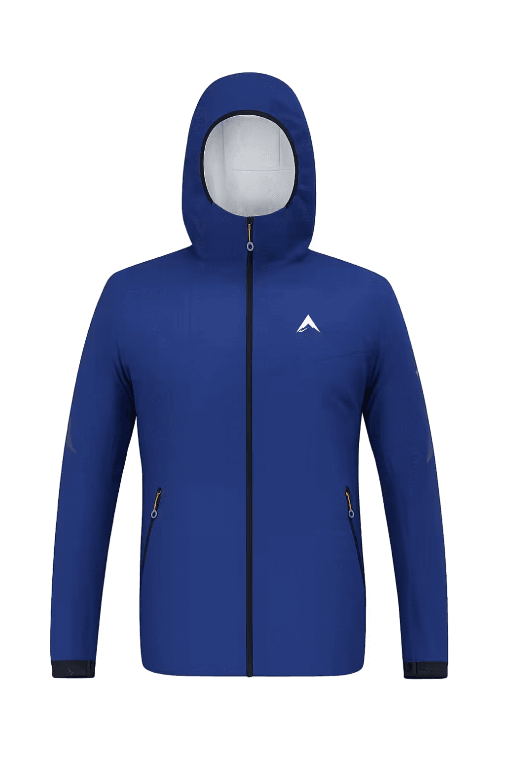
Ridgeway Outdoor Jacket
Warmth without bulk across three days of shifting alpine conditions