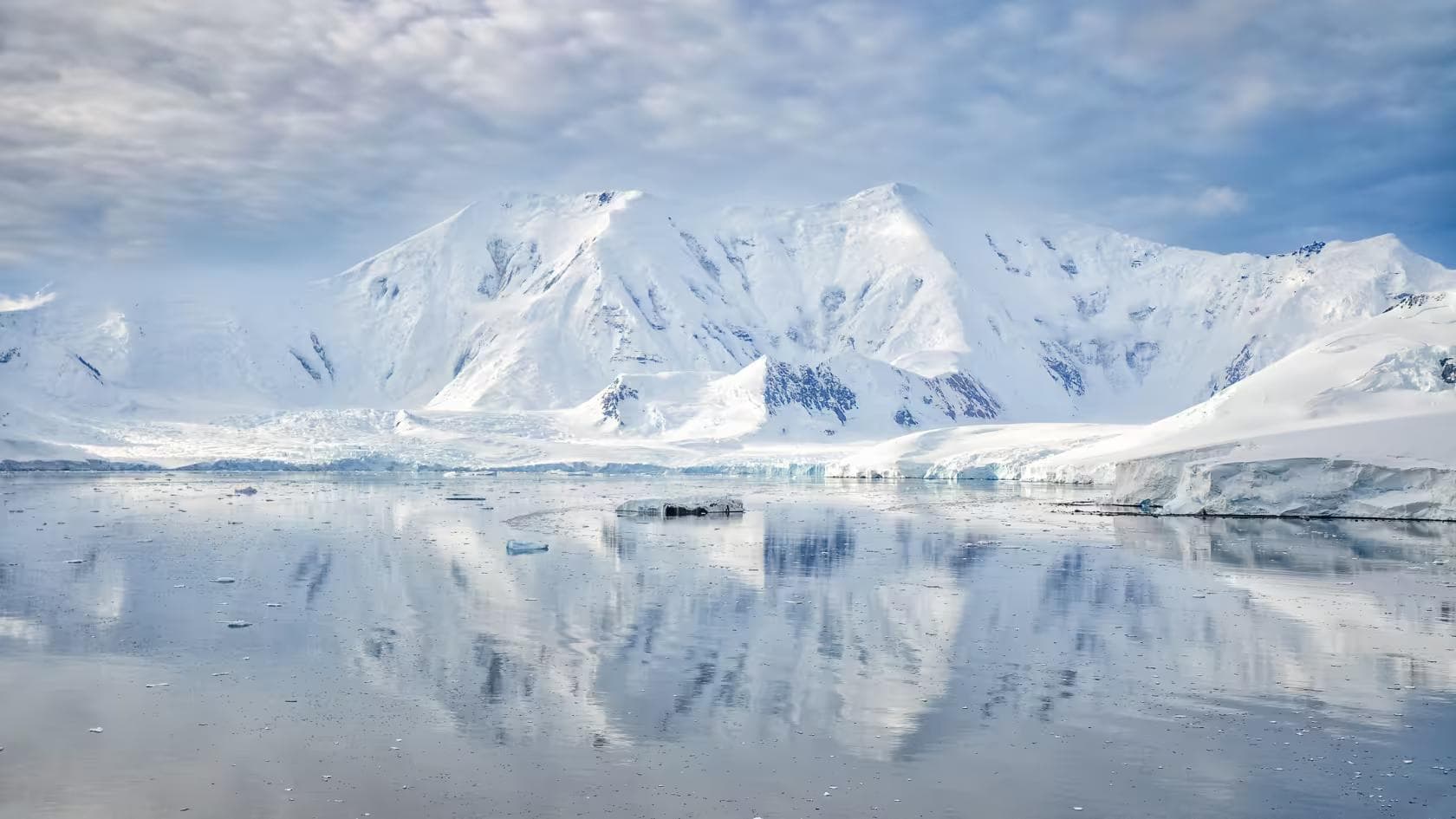
Greenland is the largest island on earth and the least densely populated. Its interior is covered by a single continuous ice sheet — 1.7 million square kilometers of compressed glacial ice averaging 2,100 meters in depth, the surface of it so flat and featureless in every direction that the horizon is geometrically identical regardless of which way the body turns. The wind crosses it without friction. There are no trees, no ridgelines, no valley geometries to deflect or moderate what the Arctic atmosphere produces. The katabatic drainage off the ice cap's dome accelerates toward the coast through a system with no interruption and no predictable schedule — it arrives when it arrives, at whatever velocity the pressure gradient has built, and the expedition on the ice manages itself around it or does not manage at all.
This itinerary covers the East Greenland coastal approach from Tasiilaq and the Sermilik Fjord to the ice sheet margin, followed by a trans-Greenland ski traverse component to 3,700 meters on the ice cap's central dome. It is the most physically demanding guide in this series by duration and isolation — three weeks in an environment where the nearest settlement is measured in days of travel rather than hours, where the weather window for safe movement is genuinely narrow, and where the expedition's self-reliance is absolute in the sense that no helicopter can reach the ice cap interior in the conditions that the ice cap interior regularly produces. The Arctic demands a different category of preparation from any alpine environment — not harder, but fundamentally different in the way that the absence of escape routes, the absence of infrastructure, and the presence of a cold that is not seasonal but structural changes the relationship between the trekker and the terrain.
01Expedition Architecture
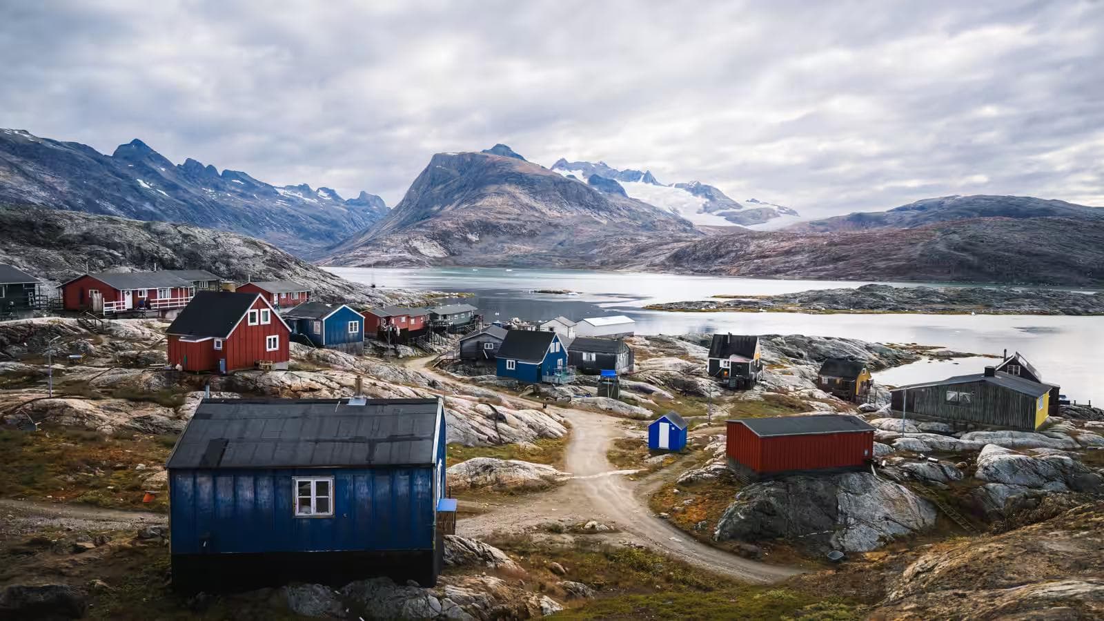
The East Greenland approach via Tasiilaq — the largest settlement on the east coast at a population of 2,000 — provides access to both the coastal fjord landscape and the ice sheet margin without the full logistical complexity of a Kangerlussuaq west coast departure. The east coast is considerably wilder than the west — fewer expedition parties, more dramatic fjord topography, the Sermilik Fjord's iceberg density in summer among the highest on the island — and the coastal approach before the ice cap entry provides acclimatization terrain that the flat west coast road to the ice does not.
The itinerary structure:
- Days 1–3: Tasiilaq arrival, fjord orientation, equipment consolidation
- Days 4–7: Sermilik Fjord traverse by boat and on foot to the ice margin
- Days 8–21: Ice cap traverse to 3,700m central dome and return
The ice cap component is conducted on cross-country skis with pulk sled — the standard polar travel system that replaces the pack-and-sled configuration of the Alaska guide with a ski-mounted mobility that the flat ice surface makes significantly more efficient than walking. Ski proficiency at an intermediate touring level is a prerequisite. The ice cap is not the environment to learn to ski on. The crevasse zones at the ice margin require rope team travel; the flat interior sections allow independent travel within satellite communicator range.
Permit & Operator Framework
Greenland expedition access is governed by the Government of Greenland's Tourism Act — which requires expedition registration for any group traveling more than 15 kilometers from a settlement. Registration is handled through the Danish Meteorological Institute for weather coordination and through Arctic Command for search and rescue notification.
Two operators with East Greenland expedition experience:
- Pirhuk Greenland Guides — Tasiilaq-based, Inuit-led, the most contextually knowledgeable operator for the east coast and ice margin approach
- Tangent Expeditions — UK-based, documented Greenland ice cap traverse experience, satellite communication infrastructure
The operator is not optional on the Greenland ice cap. The evacuation infrastructure — a fixed-wing aircraft capable of landing on the ice surface at a prepared strip — requires advance coordination with Air Greenland and a marked landing zone at a pre-agreed GPS coordinate. This cannot be arranged on the ice. It must be arranged before departure from Tasiilaq, with the aircraft on standby for the full duration of the ice cap component.
Insurance
Greenland-specific expedition insurance requires explicit coverage of:
- Fixed-wing aircraft evacuation from ice cap coordinates above 3,000m
- Medical treatment in Tasiilaq (the nearest hospital is in Nuuk, 1,000km by air)
- Expedition cancellation due to weather-enforced delay beyond the departure window
Battleface and Campbell Irvine both offer Arctic latitude expedition policies. Standard travel insurance excludes Greenland's interior by name in most comprehensive policies.
The Sermilik Fjord iceberg field between Tasiilaq and the ice margin is navigable by inflatable boat in calm conditions and genuinely dangerous in wind. Iceberg capsizing events — triggered by thermal melt destabilizing the underwater geometry of large bergs — produce waves of 1–2 meters with zero warning at distances of up to 200 meters. The operator manages fjord crossing timing based on wind and tidal conditions. Do not pressure the operator to cross in marginal conditions. The fjord crossing decision is the expedition's first consequential weather judgment, and deferring it to the person with local knowledge is the correct response regardless of schedule pressure.
02Tasiilaq: Days One–Three
Tasiilaq is reached from Copenhagen via Air Greenland through Nuuk — a total journey of approximately 7 hours in good weather, considerably longer in the weather delays that Greenland's east coast airports produce regularly. The Hotel Angmagssalik serves as the expedition base for the three preparation days — the only hotel in the settlement and the operational center for every expedition departing into the east Greenland backcountry.
The three Tasiilaq days are not rest days. They are:
- Day one — permit confirmation at the local authority office, Air Greenland evacuation aircraft coordination, operator briefing on current ice conditions at the Sermilik margin
- Day two — equipment consolidation into the pulk sled system, ski binding adjustment on the Glacier Apex Boots, satellite communicator registration and check-in schedule confirmation
- Day three — short coastal walk for acclimatization and movement assessment, weather window monitoring for the fjord crossing departure
Equipment Consolidation
The Glacier Fortress Tent, SummitCore Expedition Bag, ThermaPeak Expedition Pad, and Inferno X Expedition Stove — the camp system that sustains 14 nights on the ice — are packed into the pulk sled in a specific sequence: tent accessible at the top for rapid deployment in deteriorating conditions, sleeping system in the middle, food and fuel at the bottom where the weight sits low on the sled platform. The TerraNav Pro GPS and the CoreHeat Expedition Layer travel in the day pack — the navigation device and the primary insulation layer must be accessible without opening the sled cover in the conditions that the ice cap produces between comfortable and miserable in 20 minutes.
The pulk sled weight at departure: approximately 70–80 kilograms per person for 14 days of food, fuel, and camp system. This is not a figure that training fully prepares for. The first day on the ice — flat terrain, good visibility, fresh legs — still produces a hauling resistance that recalibrates every prior assessment of the effort involved. The body adapts within three days. The first three days require accepting the recalibration without adjusting the ambition.
03Sermilik Fjord: Days Four–Seven
The Sermilik Fjord — 60 kilometers long and 8 kilometers wide at its broadest, filled throughout the summer with icebergs calved from the Helheim Glacier at its head — is crossed in sections by inflatable Zodiac with the operator's experienced fjord guide. The iceberg density in July makes the crossing a navigation exercise through moving ice rather than open water — the boat threading between bergs that range from growler-sized to house-sized, the guide reading the surface wind and the berg movement for the 90-second windows that allow forward progress between obstacles.
Photography opportunities in the Sermilik fjord are extraordinary and entirely secondary to maintaining the spatial awareness that iceberg proximity requires. The berg that appears stable from 50 meters is the berg that capsized 30 seconds ago on its underwater axis and has not yet settled into its new equilibrium. Keep the boat at minimum 100 meters from any berg larger than the boat. The operator enforces this. Accept it.
Coastal Approach to Ice Margin
The coastal section from the fjord's inner reaches to the ice sheet margin covers 35 kilometers of East Greenland coastal terrain — tundra, moraine, glacier-fed river crossings, and the specific landscape of the ice margin where the ice sheet meets the bedrock in a chaotic zone of crevassed glacier tongues, meltwater lakes, and compressed moraines that the retreating ice has left in its recent geological wake.
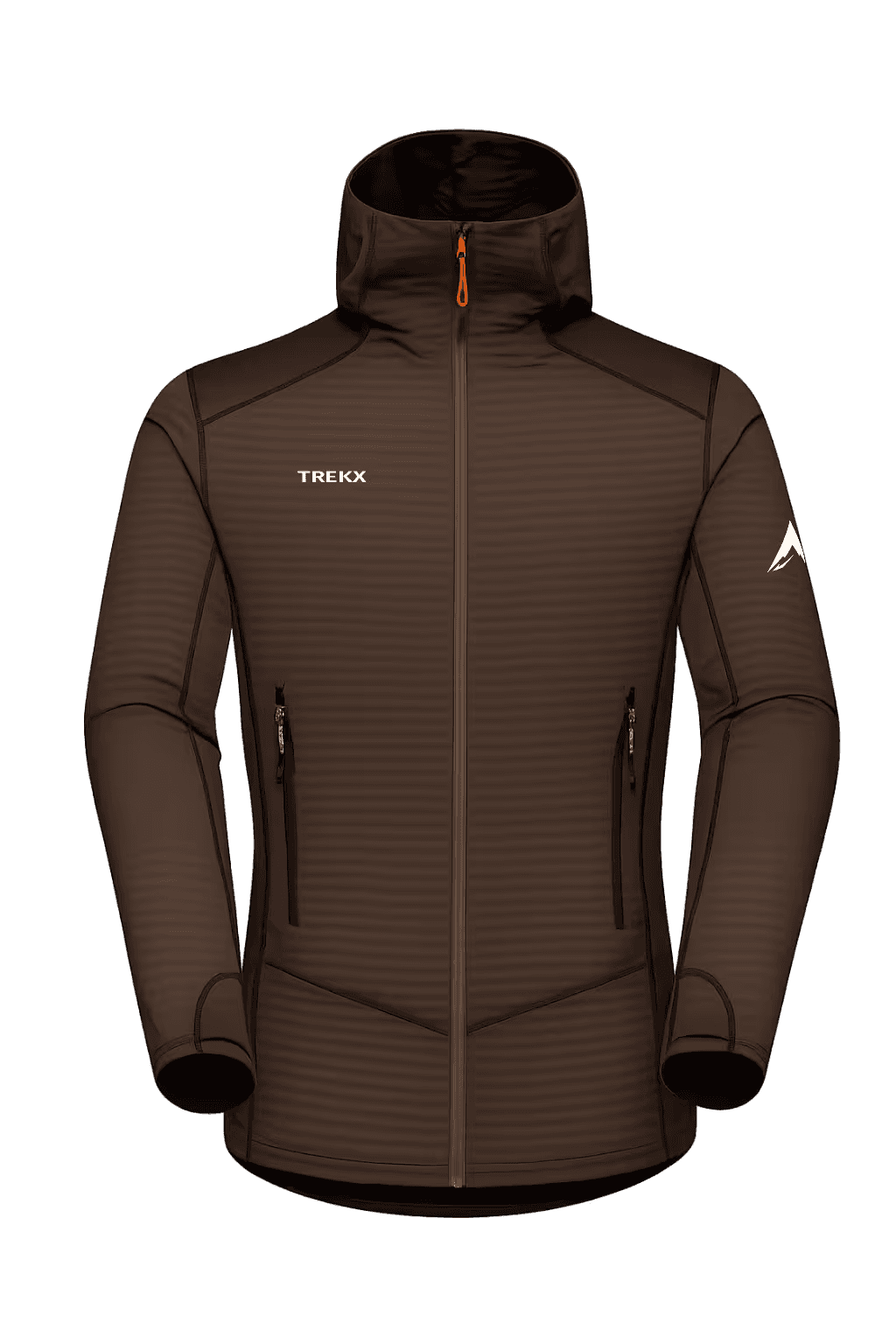
The Tempest GTX Pro Shell and Tempest GTX Bib Pants are the coastal approach system. East Greenland coastal weather is maritime in character — the moisture from the Denmark Strait produces rain, sleet, and horizontal precipitation that the GTX membrane manages across the temperature range from 5°C above treeline to -5°C at the ice margin. The bib configuration eliminates the gap that the coastal wind finds at the jacket-trouser interface on exposed ridge sections above the fjord. Both layers are worn from the first morning departure and do not come off until the tent is pitched at the ice margin camp.
The TerraNav Pro GPS manages navigation on the coastal moraine sections where the path — such as it exists — disappears into boulder fields and the visual reference to the ice margin ahead is the primary orientation tool. Download the ice margin GPS track from the operator before departure. The coastal approach route changes annually as the ice retreats and the moraine landscape adjusts to its new geometry. Last year's GPS track is directionally useful and geographically unreliable.
04Ice Cap: Days Eight–Twenty-One
The ice cap entry at the margin requires rope team travel through a crevasse zone that varies in width between 2 and 5 kilometers depending on the entry latitude. The crevasses at the ice margin are not the clean parallel slots of a mountain glacier — they are irregular, snow-bridged, and orientated by the complex stress patterns of ice flowing from the dome toward multiple coastal outlet glaciers simultaneously. Probe every snow bridge before committing weight. Move in a rope team of three minimum. Mark the entry route with wands for the return.
Above the crevasse zone, the ice surface transitions to the polar plateau — flat, wind-polished, featureless — and the rope team configuration relaxes to satellite communicator range. The GPS track to the central dome at 3,700 meters is a straight bearing north-northwest for 180 kilometers. The navigation is simple. The execution across 14 days of polar conditions is not.
Daily Rhythm on the Ice
The ice cap imposes a rhythm that has nothing to do with ambition and everything to do with the wind. The operational day on the Greenland ice cap:
- 4:00am — weather assessment. Check wind speed with the anemometer, check the horizon for storm development, check the TerraNav Pro GPS for the day's bearing.
- 5:30am — departure if conditions allow. The CoreHeat Expedition Layer goes on first, the Tempest GTX Pro Shell second, the Tempest GTX Bib Pants third. Full layers from the tent door — there is no gradual warm-up period on the polar plateau.
- 6:00am–12:00pm — ski travel. Six hours of movement at 8–12 kilometers per hour in good conditions, 3–5 kilometers per hour in wind-affected conditions, 0 kilometers per hour in a storm. The daily distance target is 20 kilometers. The daily distance achieved is whatever the weather allows.
- 12:00pm — lunch stop. 20 minutes maximum. Stopping on the polar plateau in wind produces cooling at a rate that the active travel heat does not prepare for. The CoreHeat Expedition Layer's moisture management is the system that prevents the perspiration of the morning's travel from becoming the cooling mechanism of the lunch stop. Do not remove the shell layer during the stop.
- 12:20pm–6:00pm — afternoon travel window if conditions remain stable.
- 6:30pm — camp. The Glacier Fortress Tent goes up first, before any other camp task. In Greenland, the tent is not shelter. It is survival infrastructure. Pitch it, stake all guy wires, build a snow wall on the windward side, then manage the sleeping system and the stove.
The Inferno X at -30°C
The Inferno X Expedition Stove on the Greenland ice cap operates in the conditions it was designed for and the conditions that test every camping stove beyond its specification simultaneously. Snow melting for water at -30°C ambient, inside a tent vestibule in 40 km/h wind, requires a stove that maintains canister pressure through the pre-heater system and a cook system that minimizes the time between ignition and boiling. The Inferno X's integrated windscreen reduces the fuel consumption that an unshielded stove wastes in tent vestibule drafts. At the rate of 500ml of fuel per person per day on the ice cap — for water, hot food, and the psychological warmth of a morning coffee before the tent door opens — 14 days requires 7 liters of fuel per person, carried in the pulk from the ice margin.
The ThermaPeak Expedition Pad R-value 6.0+ insulates the sleeping system from the ice below the tent floor. On the Greenland ice cap, the floor of the tent is ice. The tent platform is ice. The entire world in every direction for 180 kilometers is ice. The R-value that performs in a mountain camp performs on the ice cap only if it has been selected for the ice cap's specific ground temperature — which is 0°C at the surface and -10°C at 20cm depth, a sustained cold contact that a pad rated for alpine conditions rather than polar conditions fails at by day three.
Storm Days
On the Greenland ice cap, a storm is not an event. It is a state that the weather enters and exits on its own schedule. A three-day storm — wind above 50 km/h, visibility below 20 meters, temperature with wind chill below -40°C — is an expected feature of any three-week ice cap traverse, not an exceptional one. The expedition plan builds three storm days into the schedule. The expedition reality frequently requires all of them.
Storm day management:
- Do not travel in visibility below 50 meters. The navigation error on a featureless plateau in 20-meter visibility with no GPS confirmation is enough to travel perpendicular to the intended bearing for six hours without awareness.
- Melt water and manage fuel. Storm days consume fuel at the same rate as travel days — the stove runs for hot food and drinks — and the fuel budget must account for them.
- Manage the tent. Snow accumulation against the Glacier Fortress Tent's walls in a sustained storm requires clearance every four hours. A tent buried by snow drift loses its ventilation and gains a structural load on the windward wall that the pole system was not rated for in that configuration. Clear it. Set an alarm.
Whiteout conditions on the Greenland ice cap are the navigation emergency that the TerraNav Pro GPS was built for and that the human visual system cannot manage independently. In a whiteout — when cloud, ground, and horizon become a single undifferentiated white — the proprioceptive sense of balance becomes unreliable and unassisted walking produces a circular path rather than a straight one within 200 meters. Do not travel in whiteout without a confirmed GPS bearing updated every 100 meters. Do not assume that the whiteout will clear within an hour. On the Greenland ice cap, a whiteout can persist for 48 hours without transition. Stop, pitch the tent, and wait.
05Central Dome & Return
The central dome of the Greenland ice cap at 3,700 meters — the highest point accessible on the standard trans-Greenland traverse route — is reached on day 14 of the ice cap component in a normal weather year. The elevation is not felt in the way that mountain altitude is felt — there is no rock, no visual reference to the height, no valley below to provide scale. The altitude manifests as a slight reduction in work capacity, a marginally faster breathing rate on the ski pulls, and the specific quality of the cold at this elevation that is 8–10°C lower than the ice margin entry point at sea level.
The dome provides no view. The horizon is the same white circle in every direction that it has been for seven days of travel. What it provides instead is the knowledge of position — the GPS coordinate that confirms the traverse has reached its intended depth, the moment from which the return bearing is set, and the specific quality of standing at the center of the largest island on earth with nothing in any direction but ice and the sky above it. It is not a dramatic moment. It is a clarifying one.
The Return
The return traverse follows the outbound track in reverse — the GPS track recorded on the approach is the navigation system for the return, adjusted for the wind drift that polar travel accumulates over 7 days of movement. The return is psychologically harder than the approach for a reason that the approach does not prepare for: the terrain is identical, the direction is reversed, and the body's adaptation to the effort means the fatigue is no longer interesting, just present.
Reach the ice margin on day 20. Navigate the crevasse zone with the wands placed on entry. Cross the coastal moraine to the fjord. Signal the operator for the boat crossing. Return to Tasiilaq on day 21 with wet boots, a depleted fuel supply, and the specific understanding of the Arctic that three weeks on the ice produces — not a catalogue of hardship, but a recalibrated sense of what the body can sustain, what the weather can impose, and what silence actually sounds like when it is not a condition but the permanent character of a place.
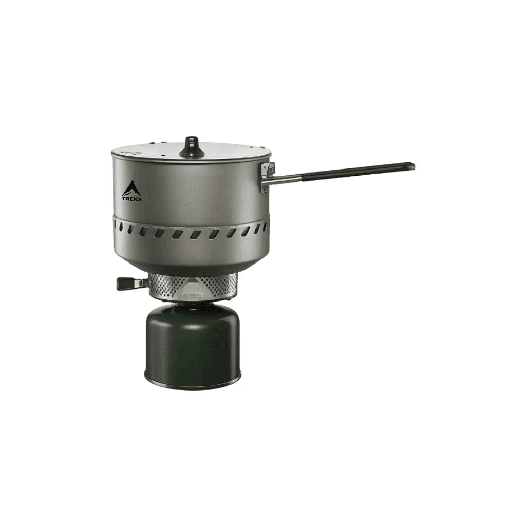
Inferno X Expedition Stove
Snow melting and hot food production at -30°C ambient across 14 ice cap nights

Glacier Fortress Tent
Fully staked, snow-walled on the windward side from the first pitch, cleared every four hours in storm accumulation
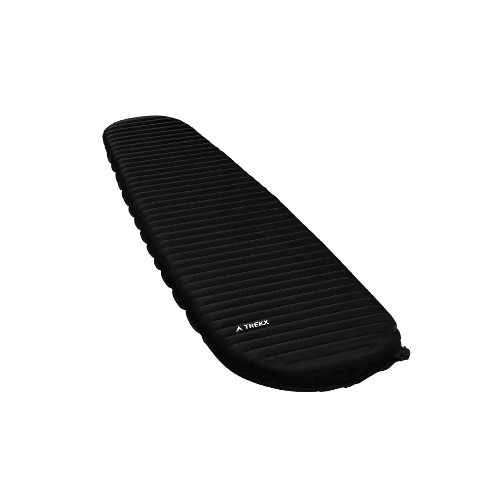
ThermaPeak Expedition Pad
The thermal break that keeps the SummitCore Expedition Bag performing to specification rather than failing to the ice temperature below it
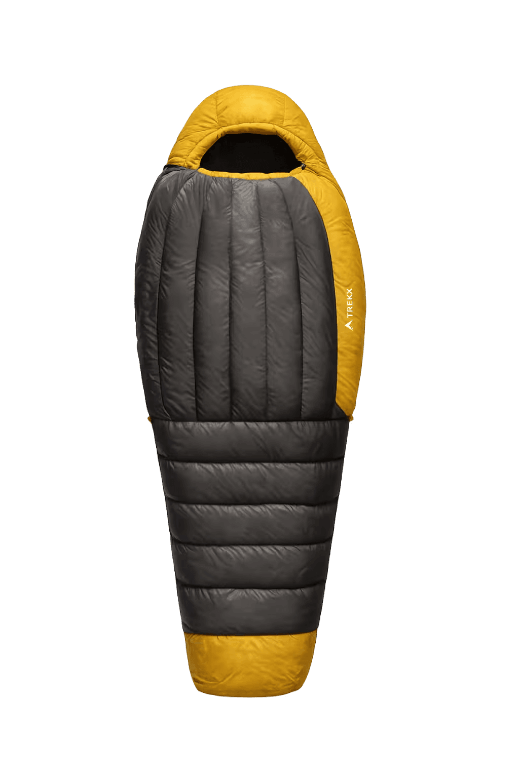
SummitCore Expedition Bag
Rated -40°C lower limit for ice cap nights where -30°C ambient and storm wind chill produce the sleeping temperature that a bag rated for alpine conditions fails to cover
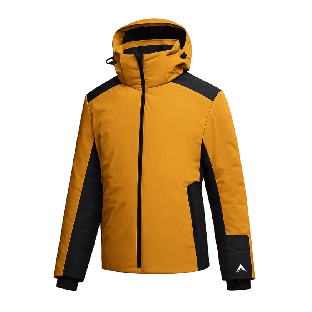
Tempest GTX Pro Shell
The primary weather barrier from the Sermilik fjord crossing through all 14 ice cap travel days
CoreHeat Expedition Layer
The base layer that keeps perspiration from becoming the cooling mechanism during the 20-minute lunch stop
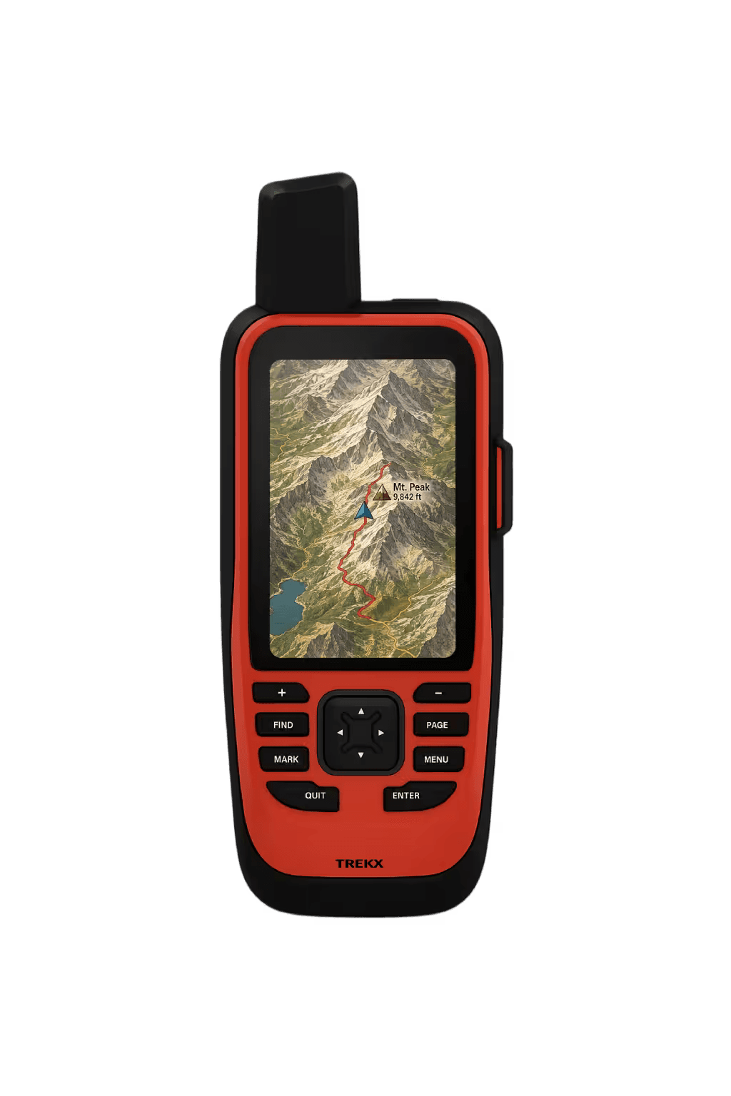
TerraNav Pro GPS
Primary navigation system for 180 kilometers of featureless polar plateau where visual navigation is impossible in whiteout. Updated every 100 meters in low-visibility conditions

Tempest GTX Bib Pants
Wind and moisture protection from the coastal fjord approach through all ice cap travel